
IMAGES TAKEN NEAR TO
Sandringham Avenue, RHYL, LL18 1NF
Introduction
This page details the photographs taken nearby to Sandringham Avenue, LL18 1NF by members of the Geograph project.
The Geograph project started in 2005 with the aim of publishing, organising and preserving representative images for every square kilometre of Great Britain, Ireland and the Isle of Man.

There are currently over 7.5m images from over14,400 individuals and you can help contribute to the project by visiting https://www.geograph.org.uk
Image Map
Images are licensed for reuse under creativecommons.org/licenses/by-sa/2.0
Notes
- Clicking on the map will re-center to the selected point.
- The higher the marker number, the further away the image location is from the centre of the postcode.
Image Listing (135 Images Found)
Images are licensed for reuse under creativecommons.org/licenses/by-sa/2.0
Image
Details
Distance
1
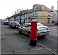
Queen Elizabeth II pillarbox, Sandringham Avenue, Rhyl
Opposite the Marlborough Grove junction. http://www.geograph.org.uk/photo/5586958
Image: © Jaggery
Taken: 1 Nov 2017
0.02 miles
2
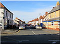
North along Sandringham Avenue, Rhyl
From Wellington Road along Sandringham Avenue towards West Parade.
Image: © Jaggery
Taken: 1 Nov 2017
0.02 miles
3
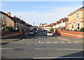
Lake Avenue, Rhyl
From Wellington Road along Lake Avenue towards North Avenue.
Image: © Jaggery
Taken: 1 Nov 2017
0.03 miles
4
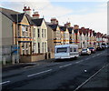
Sandringham Avenue houses, Rhyl
On the east side of the avenue, viewed from near the corner of West Parade.
Image: © Jaggery
Taken: 1 Nov 2017
0.03 miles
5
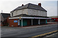
The former Harbour View Tackle Shop
On West Parade, Rhyl.
Image: © Ian S
Taken: 16 Sep 2014
0.04 miles
6
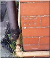
Ordnance Survey Cut Mark
This OS cut mark can be found on No36 Sandringham Avenue. It marks a point 4.736m above mean sea level.
Image: © Adrian Dust
Taken: 13 Sep 2019
0.05 miles
7
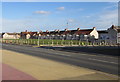
Fenced-off site, West Parade, Rhyl
Between Sydenham Avenue (on the right) and Sandringham Avenue viewed in November 2017.
A July 2009 Google Earth Street View shows Breaks Entertainment Centre here.
Image: © Jaggery
Taken: 1 Nov 2017
0.05 miles

9
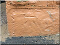
Benchmark on the old sea wall - now demolished
This benchmark was by an opening in the old Rhyl sea wall, which has all been demolished and rebuilt since 2013.
Image: © John S Turner
Taken: 1 Nov 2013
0.06 miles
10
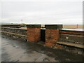
Rhyl sea wall before demolition
The old Rhyl sea wall, which was demolished and rebuilt after 2013. There was an Ordnance Survey benchmark at the base of the right hand gate post: Image
Image: © John S Turner
Taken: 1 Nov 2013
0.06 miles