
IMAGES TAKEN NEAR TO
Mount Pleasant, WREXHAM, LL14 6DT
Introduction
This page details the photographs taken nearby to Mount Pleasant, LL14 6DT by members of the Geograph project.
The Geograph project started in 2005 with the aim of publishing, organising and preserving representative images for every square kilometre of Great Britain, Ireland and the Isle of Man.

There are currently over 7.5m images from over14,400 individuals and you can help contribute to the project by visiting https://www.geograph.org.uk
Image Map
Images are licensed for reuse under creativecommons.org/licenses/by-sa/2.0
Notes
- Clicking on the map will re-center to the selected point.
- The higher the marker number, the further away the image location is from the centre of the postcode.
Image Listing (216 Images Found)
Images are licensed for reuse under creativecommons.org/licenses/by-sa/2.0
Image
Details
Distance
1
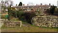
Row of stone cottages, Mount Pleasant, Ruabon
Located above the B5097 Pont Adam, Mount Pleasant is a row of ten stone
cottages dating from the mid 19th century. Ruabon Cemetery is behind the cottages.
Image: © Jaggery
Taken: 27 Feb 2016
0.01 miles
2
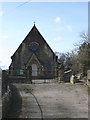
Ruabon Congregation Church
On Mount Pleasant.
Image: © Eirian Evans
Taken: 19 Mar 2008
0.02 miles
3
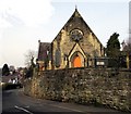
Grade II listed Ruabon Congregational Church, Ruabon
The church on the north side of the B5097 Pont Adam first opened for worship in 1858.
The building was Grade II listed in 1995.
Image: © Jaggery
Taken: 27 Feb 2016
0.04 miles
4
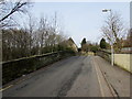
B5097 railway bridge, Ruabon
The stone bridge http://www.geograph.org.uk/photo/4851186 carries the B5097 over the Shrewsbury to Chester Line NE of Ruabon railway station. Maps show that the B5097 is Church Street on this side, Pont Adam on the far side.
Image: © Jaggery
Taken: 27 Feb 2016
0.04 miles
5
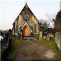
East side of Ruabon Congregational Church, Ruabon
The church on the north side of the B5097 Pont Adam first opened for worship in 1858.
The building was Grade II listed in 1995.
Image: © Jaggery
Taken: 27 Feb 2016
0.04 miles
6
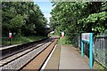
End of platform 2, Ruabon railway station
The north-eastern end of the platform, along with disused sections of platforms 1 and 2, as well as the B5097 road bridge.
Image: © El Pollock
Taken: 11 Jun 2014
0.04 miles
7
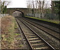
Road bridge NE of Ruabon railway station
The stone bridge carries the B5097 Church Street Ruabon over the railway.
Image: © Jaggery
Taken: 27 Feb 2016
0.04 miles
8
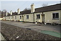
Grade II listed former almshouses, Church Street, Ruabon
Extending for 35 metres, the row of five single-storey houses is named Church Houses. Built as almshouses in 1711, renovated and extended by the Trustees of Ruabon United Charities in 1979. Grade II listed in 1963.
Image: © Jaggery
Taken: 27 Feb 2016
0.05 miles
9
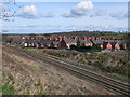
Ruabon over the Railway
The Chester to Shrewsbury line as it passes through Ruabon
Image: © Eirian Evans
Taken: 19 Mar 2008
0.05 miles
10
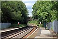
B5097 road bridge, Ruabon railway station
Situated at the north-eastern end of the platforms, viewed from platform 2.
Image: © El Pollock
Taken: 11 Jun 2014
0.05 miles