Grade II listed former almshouses, Church Street, Ruabon
Introduction
The photograph on this page of Grade II listed former almshouses, Church Street, Ruabon by Jaggery as part of the Geograph project.
The Geograph project started in 2005 with the aim of publishing, organising and preserving representative images for every square kilometre of Great Britain, Ireland and the Isle of Man.

There are currently over 7.5m images from over 14,400 individuals and you can help contribute to the project by visiting https://www.geograph.org.uk
Grade II listed former almshouses, Church Street, Ruabon
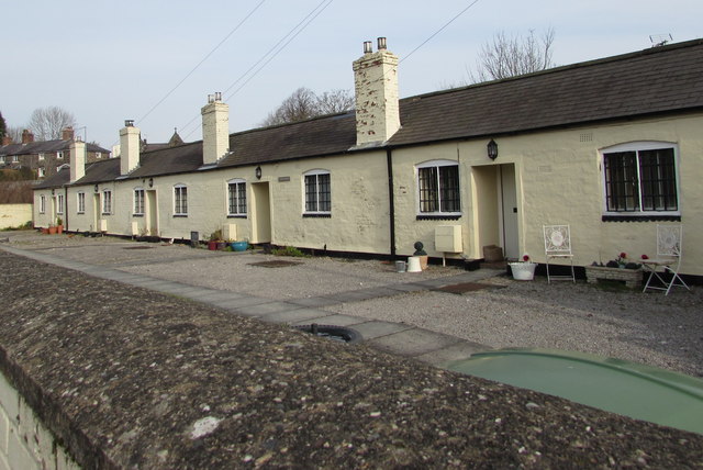
Image: © Jaggery Taken: 27 Feb 2016
Extending for 35 metres, the row of five single-storey houses is named Church Houses. Built as almshouses in 1711, renovated and extended by the Trustees of Ruabon United Charities in 1979. Grade II listed in 1963.
Images are licensed for reuse under creativecommons.org/licenses/by-sa/2.0
Image Location


Leaflet Map data © OpenStreetMap
Latitude
52.987954
Longitude
-3.041818