IMAGES TAKEN NEAR TO
Cae Coch, WREXHAM, LL14 3DL
Introduction
This page details the photographs taken nearby to Cae Coch, LL14 3DL by members of the Geograph project.
The Geograph project started in 2005 with the aim of publishing, organising and preserving representative images for every square kilometre of Great Britain, Ireland and the Isle of Man.

There are currently over 7.5m images from over14,400 individuals and you can help contribute to the project by visiting https://www.geograph.org.uk
Image Map
Images are licensed for reuse under creativecommons.org/licenses/by-sa/2.0
Notes
- Clicking on the map will re-center to the selected point.
- The higher the marker number, the further away the image location is from the centre of the postcode.
Image Listing (17 Images Found)
Images are licensed for reuse under creativecommons.org/licenses/by-sa/2.0
Image
Details
Distance
1
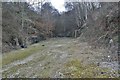
Acrefair Station old track bed
Looking towards the Ruabon end through the cut. The iron foot bridge from Cae Coch to Coed Richard is just visible through the trees.
Image: © Geraint Roberts
Taken: 24 Feb 2012
0.10 miles
2
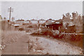
Acrefair station
Acrefair station before demolition taken in 1973.
Image: © Geraint Roberts
Taken: 18 Mar 1973
0.15 miles
3
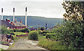
Acrefair station (site/remains), 1992
View NW, towards Llangollen and Barmouth: ex-GWR (Chester) - Ruabon - Dolgelley - Barmouth Junction line, closed 18/1/65, but partly restored by the Llangollen Railway since 1975.
Image: © Ben Brooksbank
Taken: 23 Jun 1992
0.18 miles
4
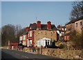
Houses on Stryd y Brenin
In the last few years the view from King Street has improved with the removal of the old phenol works (now Flexsys). Image]
Image: © John Haynes
Taken: 24 Mar 2012
0.18 miles
5
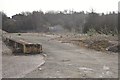
Approximate site of old Acrefair Station
Taken in March 2012,looking towards the Ruabon end of the line, Cae Coch visible behind the trees. This is the former Air Products site awaiting redevelopment.
Image: © Geraint Roberts
Taken: 2 Mar 2012
0.18 miles
6

Ordnance Survey Cut Mark
This OS cut mark can be found on the wall east side of the road. It marks a point 143.070m above mean sea level.
Image: © Adrian Dust
Taken: 30 Mar 2025
0.19 miles
7
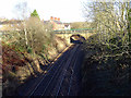
The railway to Ruabon and Wrexham
Viewed from the over-bridge at Rhosymedre.
Image: © John Lucas
Taken: 14 Jan 2016
0.21 miles
8
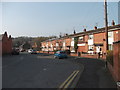
Stryd y Capel in Cefn Mawr
A modern group of terrace houses.
Image: © John Haynes
Taken: 24 Mar 2012
0.23 miles
9
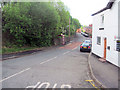
View down King Street from Llangollen road at Acrefair
Image: © John Firth
Taken: 9 May 2011
0.23 miles