
IMAGES TAKEN NEAR TO
New Foundry Court, WREXHAM, LL14 1AZ
Introduction
This page details the photographs taken nearby to New Foundry Court, LL14 1AZ by members of the Geograph project.
The Geograph project started in 2005 with the aim of publishing, organising and preserving representative images for every square kilometre of Great Britain, Ireland and the Isle of Man.

There are currently over 7.5m images from over14,400 individuals and you can help contribute to the project by visiting https://www.geograph.org.uk
Image Map
Images are licensed for reuse under creativecommons.org/licenses/by-sa/2.0
Notes
- Clicking on the map will re-center to the selected point.
- The higher the marker number, the further away the image location is from the centre of the postcode.
Image Listing (24 Images Found)
Images are licensed for reuse under creativecommons.org/licenses/by-sa/2.0
Image
Details
Distance
1
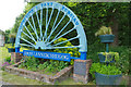
Rhosllanerchrugog
This depiction of a colliery headstock wheel is a reminder that Rhosllanerchrugog and the associated settlements of Johnstown, Pant and Ponciau were coal mining villages. The last local colliery, Bersham, closed in 1986. The plaque to the right commemorates Tom Jones, 'trade Unionist, Socialist and Spanish Republican volunteer'.
Image: © Stephen McKay
Taken: 30 May 2019
0.02 miles
2
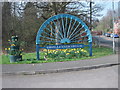
Rhosllannerchrugog village sign
This is one of several "colliery" community signs that have been commissioned to commemorate the North East Wales coalfield. The communities of Johnstown, Pant, Ponciau & Rhosllannerchrugog were all involved with the many collieries nearby.
Image]
Image]
Image: © John Haynes
Taken: 24 Mar 2012
0.02 miles
3
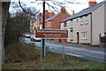
Village sign
The brown signs with the agreed modern spelling have recently been erected.
Image: © John Haynes
Taken: 15 Dec 2007
0.05 miles
4
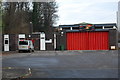
Village fire station
Johnstown / Rhosllannerchrugog fire station has a retained engine with a call out crew. It is used locally and also gives support for the main firestation in Wrecsam.
Image: © John Haynes
Taken: 15 Dec 2007
0.05 miles
5
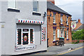
Barbers Stop and The Grapes, Johnstown
A barber's shop and the Grapes pub are neighbours on Maelor Road.
Image: © Stephen McKay
Taken: 30 May 2019
0.06 miles
6
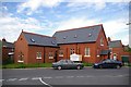
Converted chapel in Johnstown
Currently being sold by Asteris Homes. Apparently this development is the winner of the Civic Society Renovation Award for 2008. Assuming I've got the right chapel, it was originally called Seilo Chapel. Seilo probably refers to the ancient city of Shiloh, once the religious capital of Israel.
Image: © Peter Craine
Taken: 3 Jun 2008
0.08 miles
7
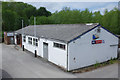
Rhos & District Royal British Legion
Looking more like a scout hut, this is a branch of the Royal British Legion incorporating the usual facilities including a bar and games room.
Image: © Stephen McKay
Taken: 30 May 2019
0.09 miles
8
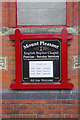
Mount Pleasant English Baptist Chapel, Ponciau
This chapel was built in 1891 to the design of architect J.G. Owen. It is evidently still going strong. Rhosllanerchrugog and the adjacent villages had (and still have) an unusually high proportion of Welsh speakers for this part of Wales so with services in other chapels conducted in Welsh no doubt there would have been a need for an English chapel to cater for the English speaking members of the community.
Image: © Stephen McKay
Taken: 30 May 2019
0.10 miles
9
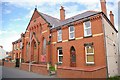
Mount Pleasant, English Baptist Chapel, Ponciau
Stones in the wall would indicate this began in 1891.
Image: © Peter Craine
Taken: 3 Jun 2008
0.10 miles
10
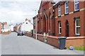
Chapel Street, Ponciau
The chapel on the right is the Mount Pleasant English Baptist Chapel built in 1891.
Image: © Stephen McKay
Taken: 30 May 2019
0.10 miles