Rhosllanerchrugog
Introduction
The photograph on this page of Rhosllanerchrugog by Stephen McKay as part of the Geograph project.
The Geograph project started in 2005 with the aim of publishing, organising and preserving representative images for every square kilometre of Great Britain, Ireland and the Isle of Man.

There are currently over 7.5m images from over 14,400 individuals and you can help contribute to the project by visiting https://www.geograph.org.uk
Rhosllanerchrugog
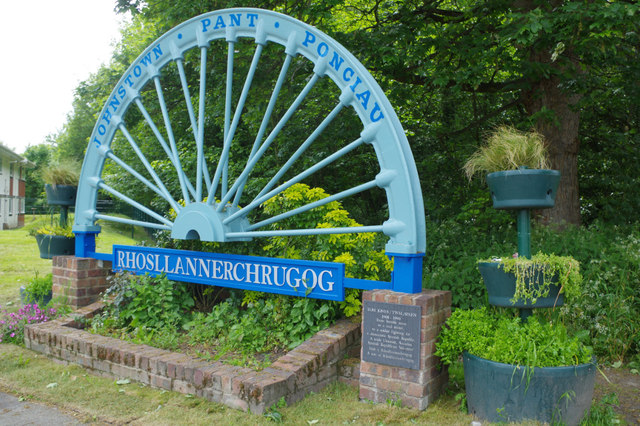
Image: © Stephen McKay Taken: 30 May 2019
This depiction of a colliery headstock wheel is a reminder that Rhosllanerchrugog and the associated settlements of Johnstown, Pant and Ponciau were coal mining villages. The last local colliery, Bersham, closed in 1986. The plaque to the right commemorates Tom Jones, 'trade Unionist, Socialist and Spanish Republican volunteer'.
Images are licensed for reuse under creativecommons.org/licenses/by-sa/2.0
Image Location
Latitude
53.00957
Longitude
-3.047406