IMAGES TAKEN NEAR TO
Bentley Place, WREXHAM, LL13 8DQ
Introduction
This page details the photographs taken nearby to Bentley Place, LL13 8DQ by members of the Geograph project.
The Geograph project started in 2005 with the aim of publishing, organising and preserving representative images for every square kilometre of Great Britain, Ireland and the Isle of Man.

There are currently over 7.5m images from over14,400 individuals and you can help contribute to the project by visiting https://www.geograph.org.uk
Image Map
Images are licensed for reuse under creativecommons.org/licenses/by-sa/2.0
Notes
- Clicking on the map will re-center to the selected point.
- The higher the marker number, the further away the image location is from the centre of the postcode.
Image Listing (11 Images Found)
Images are licensed for reuse under creativecommons.org/licenses/by-sa/2.0
Image
Details
Distance
1
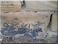
Ordnance Survey Cut Mark
This OS cut mark can be found on the wall of No25 Hightown Road. It marks a point 73.289m above mean sea level.
Image: © Adrian Dust
Taken: 22 Oct 2021
0.14 miles
2
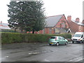
Wrexham Revival Fire Church
Pentecostal church on Bernard Road, Wrexham.
Image: © Eirian Evans
Taken: 9 Feb 2012
0.15 miles
3
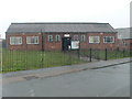
St Peter's Hall
These are Caia Park Council Rooms. St Peter's Church is just visible on the right, but it is now closed.
Image: © Eirian Evans
Taken: 9 Feb 2012
0.18 miles
4
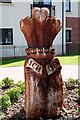
I Serve..... Who?
The newly refurbished Hightown flats complex boasts this fine piece of carving, which has connections with the Royal Welch Fusiliers who were based at the neighbouring Barracks. Except that this area many years ago was attributed to Admiral Lord Nelson e.g. Trafalgar Road, Nelson Street and Napier Street.
Image: © Geoff Evans
Taken: 10 Aug 2015
0.19 miles
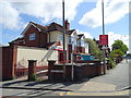
6
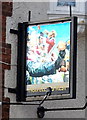
Sign for the Travellers Rest, Wrexham
See Image] for context.
Image: © JThomas
Taken: 4 May 2019
0.22 miles
7
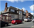
The Travellers Rest, Wrexham
On Kingsmills Road.
Image: © JThomas
Taken: 4 May 2019
0.22 miles
8
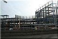
Eagles Meadows Development
The site of the new Marks & Spencer shop and Odeon Cinema from the Asda "flyover".
Image: © Geoff Evans
Taken: 13 Feb 2007
0.22 miles
9
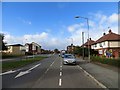
Kingsmills Road
Opposite the barracks.
Image: © Richard Webb
Taken: 19 Oct 2014
0.23 miles