1
Wrexham Maelor Hospital
The northwest corner of the hospital site viewed from the southern end of Maesgwyn Road.
Image: © Jaggery
Taken: 12 Feb 2018
0.08 miles
2
Up the Branch line
This is the view that railwaymen would have had as they exited the branch line looking back up the Brymbo/Minera Branch line from where it passed at the back of the Croesnewydd sheds.
Image: © Geoff Evans
Taken: 26 Jan 2012
0.15 miles
3
Maesgwyn Waste Water Pumping Station, Wrexham
The Welsh Water site is alongside Maesgwyn Road near this entrance https://www.geograph.org.uk/photo/5694123 to Wrexham Maelor Hospital.
Notices show Please Keep Clear - No Parking - 24 hour access required
and Potentially explosive atmospheres exist on this site.
Image: © Jaggery
Taken: 12 Feb 2018
0.15 miles
4
Watery Road level crossing, Wrexham
Croesnewydd North Fork Signalbox http://www.geograph.org.uk/photo/5129904 is on the left.
The former Crossing Keeper's Cottage http://www.geograph.org.uk/photo/5129908 is on the right.
Image: © Jaggery
Taken: 24 Sep 2016
0.15 miles
5
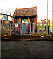
Former Crossing Keeper's Cottage at Croesnewydd North Fork, Wrexham
Located opposite Croesnewydd North Fork Signalbox, http://www.geograph.org.uk/photo/5129904 the cottage was built c1846 for the Shrewsbury and Chester Railway Company. Grade II listed in 1994.
Image: © Jaggery
Taken: 24 Sep 2016
0.15 miles
6
No Home Signal Visible
This is the view that the footplate men would have had as they exited the Minera branch line on to the Shrewsbury to Chester main line.
Image: © Geoff Evans
Taken: 26 Jan 2012
0.15 miles
7
Croesnewydd North Fork Signalbox, Wrexham
Viewed across the Watery Road level crossing.
Image: © Jaggery
Taken: 24 Sep 2016
0.16 miles
8
Croesnewydd North Fork Signalbox
Image: © N Chadwick
Taken: 19 Feb 2015
0.16 miles
9
Level Crossing, Watery Rd
Image: © N Chadwick
Taken: 19 Feb 2015
0.16 miles
10
Croesnewydd South Signal Box
The view that footplate staff would have had of the approach to the crossing gates operated by the signal box. No sign of the Permanent Way controlled by the box, but there is still a dual track connecting Wrexham and Shrewsbury which passes immediately in front of the box.
Image: © Geoff Evans
Taken: 7 Feb 2012
0.16 miles


