
IMAGES TAKEN NEAR TO
Ffordd Cwm, Coed-y-Glyn, WREXHAM, LL13 7QD
Introduction
This page details the photographs taken nearby to Ffordd Cwm, Coed-y-Glyn, LL13 7QD by members of the Geograph project.
The Geograph project started in 2005 with the aim of publishing, organising and preserving representative images for every square kilometre of Great Britain, Ireland and the Isle of Man.

There are currently over 7.5m images from over14,400 individuals and you can help contribute to the project by visiting https://www.geograph.org.uk
Image Map
Images are licensed for reuse under creativecommons.org/licenses/by-sa/2.0
Notes
- Clicking on the map will re-center to the selected point.
- The higher the marker number, the further away the image location is from the centre of the postcode.
Image Listing (19 Images Found)
Images are licensed for reuse under creativecommons.org/licenses/by-sa/2.0
Image
Details
Distance
1
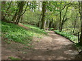
Coed y Glyn Wood
Coed-y-Glyn Wood is a haven for wildlife including badgers, foxes, owls and kestrels. There are also many old trees, mainly oak and beech, but also some more unusual species such as field maple and hornbeam.
Image: © Eirian Evans
Taken: 7 Apr 2011
0.12 miles
2
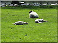
Pleasure is a sunny day
A ewe and her two lambs enjoying the sunny day, lots of others prefer the shade under a tree. The grassland is within the Erddig Country Park owned by the National Trust.
Image: © John Haynes
Taken: 4 May 2016
0.14 miles
3
The Squire Yorke
Public house on Sontley Road, Wrexham
Image: © Eirian Evans
Taken: 9 Feb 2012
0.15 miles
4

Exceedingly high hedge
Providing privacy for a property in Sontley Road.
Image: © John H Darch
Taken: 13 May 2025
0.16 miles
5
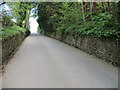
Sontley Road - and a bench mark
Looking north up Sontley Road. On the right hand stone wall there is an Ordnance Survey bench mark, just north of the clump of wild garlic. See: Image There is also supposed to be a more recent bench mark on the left hand wall, but I didn't see that.
Image: © John S Turner
Taken: 19 Apr 2014
0.17 miles
6

Bench mark on Sontley Road
This bench mark is recorded on the 1872-1954 O.S maps but is no longer recorded on the Ordnance Survey database. It is a few metres north of the well set into the roadside wall. There is supposed to be a more recent bench mark cut into the wall opposite, which is recorded on the O.S. database and the 1960-2 map, but I didn't see that mark. See also Image
Image: © John S Turner
Taken: 19 Apr 2014
0.18 miles
7
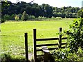
Stile in Erddig Country Park
View towards lake and River Clywedog
Image: © Raymond Knapman
Taken: 30 Aug 2010
0.18 miles
8
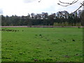
Erddig parkland
Looking south towards Erddig's lake.
Image: © Eirian Evans
Taken: 7 Apr 2011
0.19 miles
9
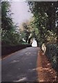
Sontley Road
Looking up the 1 in 7 hill that is the Sontley Road, looking towards Wrexham.
Image: © Geoff Evans
Taken: 14 Oct 2009
0.19 miles
10
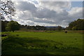
Looking up the Clywedog valley at Sontley Bridge
Image: © Christopher Hilton
Taken: 15 Apr 2017
0.22 miles