
IMAGES TAKEN NEAR TO
The Beeches, WREXHAM, LL12 7BH
Introduction
This page details the photographs taken nearby to The Beeches, LL12 7BH by members of the Geograph project.
The Geograph project started in 2005 with the aim of publishing, organising and preserving representative images for every square kilometre of Great Britain, Ireland and the Isle of Man.

There are currently over 7.5m images from over14,400 individuals and you can help contribute to the project by visiting https://www.geograph.org.uk
Image Map
Images are licensed for reuse under creativecommons.org/licenses/by-sa/2.0
Notes
- Clicking on the map will re-center to the selected point.
- The higher the marker number, the further away the image location is from the centre of the postcode.
Image Listing (12 Images Found)
Images are licensed for reuse under creativecommons.org/licenses/by-sa/2.0
Image
Details
Distance
1
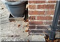
Ordnance Survey Cut Mark
This OS cut mark can be found on No36 The Beeches. It marks a point 82.208m above mean sea level.
Image: © Adrian Dust
Taken: 22 Oct 2021
0.11 miles
2
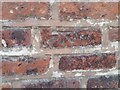
Ordnance Survey Cut Mark
This OS cut mark can be found on the garage at the rear of No29 Chester Road. It marks a point 84.981m above mean sea level.
Image: © Adrian Dust
Taken: 22 Oct 2021
0.11 miles
3
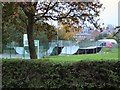
Skate Park
Course for skateboarders at Rhosddu, Wrexham.
Image: © Roger May
Taken: 15 Oct 2005
0.17 miles
4
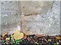
Ordnance Survey Cut Mark
This OS cut mark can be found on the wall south side of Prices Lane. It marks a point 84.597m above mean sea level.
Image: © Adrian Dust
Taken: 22 Oct 2021
0.17 miles
5
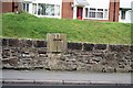
Croes Eneurys
This cross formed part of the original boundary wall of the Acton Estate.
Image: © Geoff Evans
Taken: 27 Feb 2012
0.20 miles
6
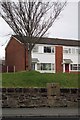
Croes-Eneurys (Eneurys' Cross )
This stone, part of the original stone estate wall (Acton Park) was relocated when the original Chester road was built. It had formed an earlier base of a cross, and was so marked to illustate its Christian origin.
Image: © Geoff Evans
Taken: 27 Feb 2012
0.21 miles
7
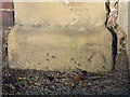
Weathered bench mark in Chester Road, Wrexham
This bench mark is on a stone post at the junction of Chester Road and Grove Road. It is next to a more modern water stop valve marker post. See also Image
Image: © John S Turner
Taken: 5 Jan 2015
0.21 miles
8
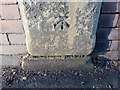
Bench mark in Chester Road, Wrexham
This bench mark is on a stone post to the north of the Chester Road/Grove Road junction. See also Image
Image: © John S Turner
Taken: 5 Jan 2015
0.21 miles
9
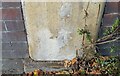
Ordnance Survey Cut Mark
This OS cut mark can be found on the wall post west side of Chester Road. It marks a point 85.250m above mean sea level.
Image: © Adrian Dust
Taken: 22 Oct 2021
0.21 miles
10
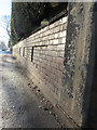
Chester Road and a bench mark
Looking south along Chester Road. There is an Ordnance Survey Bench mark on the stone post on the right: Image
Image: © John S Turner
Taken: 5 Jan 2015
0.22 miles