
IMAGES TAKEN NEAR TO
Victoria Road, WREXHAM, LL11 6NF
Introduction
This page details the photographs taken nearby to Victoria Road, LL11 6NF by members of the Geograph project.
The Geograph project started in 2005 with the aim of publishing, organising and preserving representative images for every square kilometre of Great Britain, Ireland and the Isle of Man.

There are currently over 7.5m images from over14,400 individuals and you can help contribute to the project by visiting https://www.geograph.org.uk
Image Map
Images are licensed for reuse under creativecommons.org/licenses/by-sa/2.0
Notes
- Clicking on the map will re-center to the selected point.
- The higher the marker number, the further away the image location is from the centre of the postcode.
Image Listing (20 Images Found)
Images are licensed for reuse under creativecommons.org/licenses/by-sa/2.0
Image
Details
Distance
1
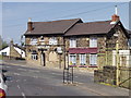
The Castle Inn, Brynteg
Local in a area of traditional house clustering on steep hills.
http://www.enjoyengland.com/campaign/taste/tasteengland/Tours/Marstons.aspx
Image: © John Haynes
Taken: 29 Apr 2006
0.13 miles
2
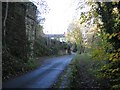
Capper's Hill in Moss Valley
The road Capper's Hill heads uphill from the car parks at Pool Mouth in the Moss Valley Country Park. The bridge abutment on the left once carried the GWR Moss Valley branch line across the road at this point. I don't know when the branch line was built but it is first shown on the 1900 O.S. map, but not on the 1879 map.
Image: © John S Turner
Taken: 7 Nov 2008
0.14 miles
4
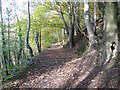
Upper footpath at Moss Valley Country Park
The high-level footpath at Moss Valley Country Park in the woods above the eastern shore of the upper lake. This view is looking north from near the disused quarry - Image
http://www.wrexham.gov.uk/english/leisure_tourism/moss_valley.htm
Image: © John S Turner
Taken: 7 Nov 2008
0.19 miles
5
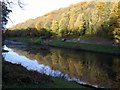
Upper lake at Moss Valley Country Park
A view from Capper's Hill road across the upper lake at Moss Valley Country Park.
Image: © John S Turner
Taken: 7 Nov 2008
0.19 miles
6
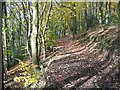
Trees and shadows at Moss Valley Country Park
Looking along the high level footpath above the eastern side of the upper lake at Moss Valley Country Park.
Image: © John S Turner
Taken: 7 Nov 2008
0.20 miles
7
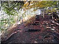
Steps up by the disused quarry at Moss Valley Country Park
The footpath follows this flight of steps up the northern edge of the disused quarry Image See also Image The edge of the quarry is marked by a clear fence but adventurous children still need to be monitored. http://www.wrexham.gov.uk/english/leisure_tourism/moss_valley.htm
Image: © John S Turner
Taken: 7 Nov 2008
0.20 miles
8
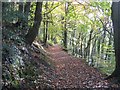
Upper footpath at Moss Valley Country Park
The high-level footpath at Moss Valley Country Park in the woods above the eastern shore of the upper lake. This view is looking south from near the disused quarry - Image
http://www.wrexham.gov.uk/english/leisure_tourism/moss_valley.htm
Image: © John S Turner
Taken: 7 Nov 2008
0.20 miles
9
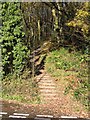
Moss Valley Country Park
A staircase leading up into the woods at Moss Valley Country Park. It starts from the lane where it separates the two car parks.
Image: © John S Turner
Taken: 26 Nov 2006
0.21 miles
10
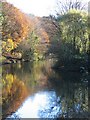
Lower Lake at Moss Valley Country Park
Autumn has really arrived at Moss Valley Country Park. Taken from the car park, above the sluices between the upper and lower lakes, on the right can be seen the island, which gives the wildlife some protection from predators. There are footpaths right around the lake, and on the left hand side one of the small fishing platforms can be seen.
Image: © John S Turner
Taken: 26 Nov 2006
0.21 miles