Capper's Hill in Moss Valley
Introduction
The photograph on this page of Capper's Hill in Moss Valley by John S Turner as part of the Geograph project.
The Geograph project started in 2005 with the aim of publishing, organising and preserving representative images for every square kilometre of Great Britain, Ireland and the Isle of Man.

There are currently over 7.5m images from over 14,400 individuals and you can help contribute to the project by visiting https://www.geograph.org.uk
Capper's Hill in Moss Valley
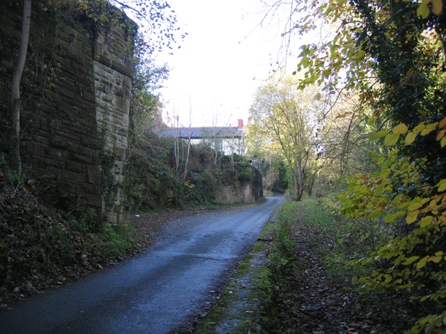
Image: © John S Turner Taken: 7 Nov 2008
The road Capper's Hill heads uphill from the car parks at Pool Mouth in the Moss Valley Country Park. The bridge abutment on the left once carried the GWR Moss Valley branch line across the road at this point. I don't know when the branch line was built but it is first shown on the 1900 O.S. map, but not on the 1879 map.
Images are licensed for reuse under creativecommons.org/licenses/by-sa/2.0
Image Location
Latitude
53.064643
Longitude
-3.030535