
IMAGES TAKEN NEAR TO
Station Road, WREXHAM, LL11 6BG
Introduction
This page details the photographs taken nearby to Station Road, LL11 6BG by members of the Geograph project.
The Geograph project started in 2005 with the aim of publishing, organising and preserving representative images for every square kilometre of Great Britain, Ireland and the Isle of Man.

There are currently over 7.5m images from over14,400 individuals and you can help contribute to the project by visiting https://www.geograph.org.uk
Image Map
Images are licensed for reuse under creativecommons.org/licenses/by-sa/2.0
Notes
- Clicking on the map will re-center to the selected point.
- The higher the marker number, the further away the image location is from the centre of the postcode.
Image Listing (23 Images Found)
Images are licensed for reuse under creativecommons.org/licenses/by-sa/2.0
Image
Details
Distance
1
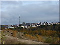
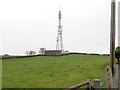
View across to Moss and the transmitter
Looking over part of the huge area cleared when Brymbo steelworks closed. Some new trees are starting to grow.
Compare with similar view from 2005 Image
Image: © Peter Aikman
Taken: 17 Nov 2013
0.06 miles
2
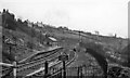
Brymbo (GW) Station (remains)
View SE, towards Wrexham; ex-Great Western Wrexham - Minera line, junction of ex-London & North Western branch from Mold. The GWR passenger service from Minera (Berwig Halt) was cut back to Coed Poeth in 1/26 and through to Wrexham on 1/1/31; the station was closed on 27/3/50 when the service from Mold ceased. However, Brymbo station remained open for goods until 2/11/64 and the line saw through goods trains until 1/10/82.
Image: © Ben Brooksbank
Taken: 19 Apr 1962
0.08 miles
3
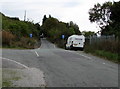
Railway Road towards Station Road, Brymbo
One-way street signs are behind the white van.
Old maps show a railway station nearby, and several others in the vicinity.
Image: © Jaggery
Taken: 24 Sep 2016
0.09 miles
4
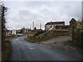
Street scene in Moss
Looking up Long Lane to the junction with Station Road, Clayton Road, and High Street.
Image: © Peter Aikman
Taken: 17 Nov 2013
0.09 miles
5
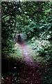
Path and steps towards Long Lane, Pentre Broughton
From the east side of the B5101 New Road,
where a sign pointing this way shows 300 yards to Long Lane.
Image: © Jaggery
Taken: 24 Sep 2016
0.09 miles
7
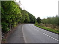
Bend in New Road south of Brymbo
A small red-edged sign on the right side of the B5101 New Road shows 40 (mph speed limit).
Image: © Jaggery
Taken: 24 Sep 2016
0.12 miles
8
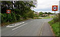
Start of the 30 zone on the approach to Brymbo
The 40mph speed limit on the B5101 New Road drops to 30mph.
Image: © Jaggery
Taken: 24 Sep 2016
0.14 miles
9
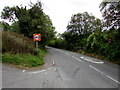
End of the 30 zone beyond Brymbo
The 30mph speed limit on the B5101 New Road increases to 40mph.
Image: © Jaggery
Taken: 24 Sep 2016
0.14 miles
10
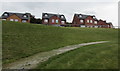
Nant Court houses, Brymbo
Part of a recently-built area of houses above the B5101, viewed in September 2016.
Image: © Jaggery
Taken: 24 Sep 2016
0.14 miles