
IMAGES TAKEN NEAR TO
St. Albans Road, WREXHAM, LL11 5TB
Introduction
This page details the photographs taken nearby to St. Albans Road, LL11 5TB by members of the Geograph project.
The Geograph project started in 2005 with the aim of publishing, organising and preserving representative images for every square kilometre of Great Britain, Ireland and the Isle of Man.

There are currently over 7.5m images from over14,400 individuals and you can help contribute to the project by visiting https://www.geograph.org.uk
Image Map
Images are licensed for reuse under creativecommons.org/licenses/by-sa/2.0
Notes
- Clicking on the map will re-center to the selected point.
- The higher the marker number, the further away the image location is from the centre of the postcode.
Image Listing (5 Images Found)
Images are licensed for reuse under creativecommons.org/licenses/by-sa/2.0
Image
Details
Distance
1
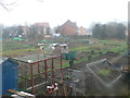
Tanyfron Allotments
Tanyfron has 18 half plots and 2 quarter plots.
Image: © Eirian Evans
Taken: 9 Feb 2012
0.19 miles
2
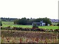
Sports Grounds, Tanyfron
The football pitches, and lower down the cricket pitches, form a sizeable playing fields.
Image: © Roger May
Taken: 26 Aug 2005
0.19 miles
3
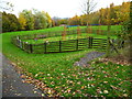
Children's play area on the west side of Tanyfron
A path on the left leads down into the village
Image: © Maggie Cox
Taken: 15 Nov 2013
0.22 miles
4
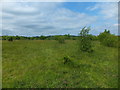
Plas Power Colliery bing
When a mine closes the bing will always be a legacy of the mine. The European coal and steel fund, local and regional authorities and national governments are all possible sources of funds to convert bings and the colliery sites so that they can be "greened up" or converted to other uses. In the North Wales Coalfield I have seen various old colliery sites that have been tidied up.
Image]
Image]
Image]
Image: © John Haynes
Taken: 1 Jun 2016
0.23 miles
5
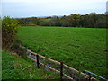
Grazing fields east of Vron Farm
The Afon Gwenfro runs through the strip of woodland. In the distance are views across the Cheshire Plain
Image: © Maggie Cox
Taken: 15 Nov 2013
0.25 miles