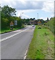
IMAGES TAKEN NEAR TO
Cortanis Lane, LEICESTER, LE9 9QR

Introduction

This page details the photographs taken nearby to Cortanis Lane, LE9 9QR by members of the Geograph project.

The Geograph project started in 2005 with the aim of publishing, organising and preserving representative images for every square kilometre of Great Britain, Ireland and the Isle of Man.

There are currently over 7.5m images from over14,400 individuals and you can help contribute to the project by visiting https://www.geograph.org.uk

Image Map


Images are licensed for reuse under creativecommons.org/licenses/by-sa/2.0
Notes
  • Clicking on the map will re-center to the selected point.
  • The higher the marker number, the further away the image location is from the centre of the postcode.

Image Listing (9 Images Found)

Images are licensed for reuse under creativecommons.org/licenses/by-sa/2.0
Image
Details
Distance
1
Barns Way, Desford
Image: © Mat Fascione Taken: 7 Jul 2007
0.06 miles
2
View north from Leicester Lane
On the eastern edge of Desford in Leicestershire.
Image: © Mat Fascione Taken: 17 Feb 2008
0.07 miles
3
Approaching Desford along Leicester Lane
Image: © Mat Fascione Taken: 7 Jul 2007
0.08 miles
4
Fuller Close, Desford
A small housing estate tucked into a triangle of land formed by Leicester Lane, Station Road and Barns Way.
Image: © Kate Jewell Taken: 21 Sep 2006
0.09 miles
5
Entering Desford on B582
Image: © N Chadwick Taken: 5 Jul 2015
0.10 miles
6
Bosworth Community and Sports College, Desford
An upper school for 14-18 year olds in Leicestershire which gained specialist sports status in 2003. Parts of Leicestershire operate a three tier education system: small village primary schools feeding into medium sized high schools at 10 or 11 which in turn feed into larger upper schools at 14. This system has its supporters who believe the children gain a more adult and confident attitude moving to a different school for Key Stage Four and the sixth form. There are those, however, that think this move is disruptive and can undermine potential. The debate continues year after year.
Image: © Kate Jewell Taken: 21 Sep 2006
0.14 miles
7
Hay bales near Desford
Image: © Mat Fascione Taken: 26 Sep 2010
0.16 miles
8
Farmland on the edge of Desford.
The industrial buildings are on Desford Lane, Newtown Unthank, Image
Image: © Kate Jewell Taken: 21 Sep 2006
0.17 miles
9
Farmland viewed from Station Road
Image: © Mat Fascione Taken: 26 Sep 2010
0.20 miles