1
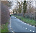
Covert Lane in Scraptoft
Image: © Mat Fascione
Taken: 9 Dec 2012
0.04 miles
2
Clearance and Demolition at Scraptoft Campus, Leicester
Once a Teacher Training College, De Montfort University's Scraptoft Campus was closed in 2003 and is now a vast demolition and redevelopment site.
Image: © Kate Jewell
Taken: 3 Jan 2006
0.07 miles
3
Mitchell Grove Open Space and Play Area, Scraptoft
Image: © Tim Heaton
Taken: 10 Jul 2019
0.09 miles
4
Malsbury Avenue in Scraptoft, Leicester
Image: © Mat Fascione
Taken: 23 Jul 2017
0.12 miles
5
Grotto, The Mound, Scraptoft
Interior detail showing the remnants of the shell and stone decoration. See http://www.geograph.org.uk/photo/5734947 for location.
Image: © Alan Murray-Rust
Taken: 5 Apr 2018
0.13 miles
6
Grotto, The Mound, Scraptoft
Originally part of the grounds of Scraptoft Hall, this is a late 18th century folly. Its location close to post-war housing estates on the outskirts of Leicester has rendered it vulnerable to vandals. The roof, which was vaulted, originally came forward to the front wall. The interior was decorated with shells http://www.geograph.org.uk/photo/5734949 and coloured stone, but these have been largely broken off. Listed Grade II.
Image: © Alan Murray-Rust
Taken: 5 Apr 2018
0.13 miles
7
Pavilion Road, Scraptoft
New housing, developed between 2010 and 2015.
Image: © Alan Murray-Rust
Taken: 5 Apr 2018
0.14 miles
8
Sports field, Scraptoft
The building looks pretty desolate, but the pitches are clearly still in use.
Image: © Alan Murray-Rust
Taken: 5 Apr 2018
0.15 miles
9
New housing development, Beeby Road, Scraptoft
Together with the Pavilion Road development, this represents a major expansion of the village of Scraptoft.
Image: © Alan Murray-Rust
Taken: 5 Apr 2018
0.17 miles
10
Welcome to Scholars Grange at Scraptoft
New housing estate on the extreme eastern fringes of Leicester.
Image: © Mat Fascione
Taken: 17 Jun 2007
0.17 miles


