Grotto, The Mound, Scraptoft
Introduction
The photograph on this page of Grotto, The Mound, Scraptoft by Alan Murray-Rust as part of the Geograph project.
The Geograph project started in 2005 with the aim of publishing, organising and preserving representative images for every square kilometre of Great Britain, Ireland and the Isle of Man.

There are currently over 7.5m images from over 14,400 individuals and you can help contribute to the project by visiting https://www.geograph.org.uk
Grotto, The Mound, Scraptoft
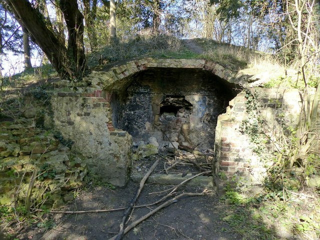
Image: © Alan Murray-Rust Taken: 5 Apr 2018
Originally part of the grounds of Scraptoft Hall, this is a late 18th century folly. Its location close to post-war housing estates on the outskirts of Leicester has rendered it vulnerable to vandals. The roof, which was vaulted, originally came forward to the front wall. The interior was decorated with shells http://www.geograph.org.uk/photo/5734949 and coloured stone, but these have been largely broken off. Listed Grade II.
Images are licensed for reuse under creativecommons.org/licenses/by-sa/2.0
Image Location
Latitude
52.64655
Longitude
-1.035552