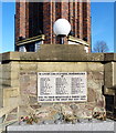
IMAGES TAKEN NEAR TO
High Street, COALVILLE, LE67 3EX

Introduction

This page details the photographs taken nearby to High Street, LE67 3EX by members of the Geograph project.

The Geograph project started in 2005 with the aim of publishing, organising and preserving representative images for every square kilometre of Great Britain, Ireland and the Isle of Man.

There are currently over 7.5m images from over14,400 individuals and you can help contribute to the project by visiting https://www.geograph.org.uk

Image Map


Images are licensed for reuse under creativecommons.org/licenses/by-sa/2.0
Notes
  • Clicking on the map will re-center to the selected point.
  • The higher the marker number, the further away the image location is from the centre of the postcode.

Image Listing (59 Images Found)

Images are licensed for reuse under creativecommons.org/licenses/by-sa/2.0
  • ...
Image
Details
Distance
1
Cut Bench Mark, Pick and Shovel Public House
Bench Mark Database: https://www.bench-marks.org.uk/bm43863
Image: © Mark Anderson Taken: 10 Jul 2012
0.01 miles
2
Pick and Shovel Public House
There is a cut bench mark to the right of the photograph and a closer view can be seen here: Image
Image: © Mark Anderson Taken: 10 Jul 2012
0.01 miles
3
Coalville Red House Pub
High Street.
Image: © the bitterman Taken: 1 Aug 2010
0.02 miles
4
Memorial Square in Coalville
Image: © Mat Fascione Taken: 8 Feb 2015
0.02 miles
5
Snibstone New Inn
Public house on Belvoir Road. Single room around L-shaped bar, games machine, TV, garden; cask ale on offer: Marston's Pedigree.
Image: © Mike Faherty Taken: 6 Oct 2012
0.02 miles
6
Clock Tower War Memorial
This Grade II listed building is 68 feet tall and stands in Memorial Square. It was built in 1925 and is a war memorial to the memory of Coalville residents who gave their lives in both world wars.
Image: © Mat Fascione Taken: 8 Feb 2015
0.03 miles
7
Belvoir Road in Coalville
The Monkey Walk Wetherspoon public house is on the corner of Marlborough Square.
Image: © Mat Fascione Taken: 8 Feb 2015
0.03 miles
8
Coalville Snibstone New Inn
2 Belvoir Road.
Image: © the bitterman Taken: 1 Aug 2010
0.03 miles
9
The Clock Tower War Memorial
This Grade II listed building is 68 feet tall and stands in Memorial Square. It was built in 1925 and is a war memorial to the memory of Coalville residents who gave their lives in both world wars.
Image: © Mat Fascione Taken: 8 Feb 2015
0.03 miles
10
Clock Tower War Memorial
This Grade II listed building is 68 feet tall and stands in Memorial Square. It was built in 1925 and is a war memorial to the memory of Coalville residents who gave their lives in both world wars.
Image: © Mat Fascione Taken: 8 Feb 2015
0.03 miles
  • ...