IMAGES TAKEN NEAR TO
Leicester Road, COALVILLE, LE67 2AR
Introduction
This page details the photographs taken nearby to Leicester Road, LE67 2AR by members of the Geograph project.
The Geograph project started in 2005 with the aim of publishing, organising and preserving representative images for every square kilometre of Great Britain, Ireland and the Isle of Man.

There are currently over 7.5m images from over14,400 individuals and you can help contribute to the project by visiting https://www.geograph.org.uk
Image Map
Images are licensed for reuse under creativecommons.org/licenses/by-sa/2.0
Notes
- Clicking on the map will re-center to the selected point.
- The higher the marker number, the further away the image location is from the centre of the postcode.
Image Listing (18 Images Found)
Images are licensed for reuse under creativecommons.org/licenses/by-sa/2.0
Image
Details
Distance
2
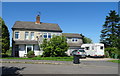
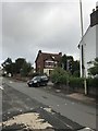
Former service station on Leicester Road, Ravenstone
Image: © JThomas
Taken: 27 Jun 2019
0.07 miles
3
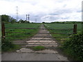
Bosworth Trail
Part of Route 52 of the National Cycle Network this section is near to Snibston Discovery Park.
Image: © Michael Patterson
Taken: 24 May 2006
0.09 miles
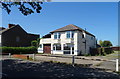
4
Leicester Road, Ravenstone
Shortly entering Snibston.
Image: © JThomas
Taken: 27 Jun 2019
0.10 miles
8
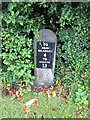
Milestone, Ravenstone
Carved stone post with metal attachment, on the UC road, in the parish of Ravenstone with Snibston (North-West Leicestershire District); Leicester Road, next to village institute, against hedge, on South side of road. The inscription reads: // TO / ASHBY / DELAZOUCH / 4 / TO / LEICESTER / 13 //. C19, erected by the Ashby-de-la-Zouch Turnpike Trust. Not listed by Historic England. Part of a national survey of wayside features by the Milestone Society: https://www.milestonesociety.co.uk/ Milestone Society ID: LE_AZLE04.
Image: © Elliott Hill
Taken: 8 Jun 2019
0.16 miles
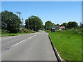
9
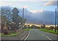
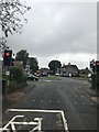
Melbourne Road at Ravenstone
Looking north at dusk along the main A447 as it passes through the outskirts of the village. Jenny's Lane off to the left and the narrow St Mary's Lane off to the right.
Image: © Trevor Rickard
Taken: 15 Aug 2009
0.16 miles
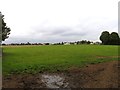
10
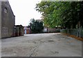
Snibston Primary School playground
Snibston Primary School combined with Ravenstone Primary School in 2005 to form Woodstone Primary School in new premises on the outskirts of Ravenstone.
Image: © Andrew Tatlow
Taken: 19 Sep 2011
0.17 miles