IMAGES TAKEN NEAR TO
Astill Close, LEICESTER, LE6 0SA

Introduction

This page details the photographs taken nearby to Astill Close, LE6 0SA by members of the Geograph project.

The Geograph project started in 2005 with the aim of publishing, organising and preserving representative images for every square kilometre of Great Britain, Ireland and the Isle of Man.

There are currently over 7.5m images from over14,400 individuals and you can help contribute to the project by visiting https://www.geograph.org.uk

Image Map


Images are licensed for reuse under creativecommons.org/licenses/by-sa/2.0
Notes
  • Clicking on the map will re-center to the selected point.
  • The higher the marker number, the further away the image location is from the centre of the postcode.

Image Listing (20 Images Found)

Images are licensed for reuse under creativecommons.org/licenses/by-sa/2.0
Image
Details
Distance
1
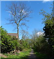
The Ivanhoe Trail in Ratby
Image: © Mat Fascione Taken: 15 Apr 2014
0.12 miles
2
Cycle Route 63 entering Ratby
Image: © Tim Heaton Taken: 19 Apr 2019
0.12 miles
3
Improvement work along the Ivanhoe Trail
National Cycle Route No.63 also runs along the trail. On the left is a temporary construction compound. This stretch of the trail runs between the M1 motorway bridge and Taverner Drive.
Image: © Mat Fascione Taken: 13 Sep 2014
0.12 miles
4
Ivanhoe Trail passing under the M1 motorway
National Cycle Route No.63 also runs along the trail, which is undergoing improvement work.
Image: © Mat Fascione Taken: 15 Apr 2014
0.13 miles
5
Ivanhoe Trail signpost near Ratby
On the former Leicester to Swannington railway, now a cyclepath.
Image: © Jim Barton Taken: 14 Sep 2019
0.13 miles
6
Plaque for the Leicester - Swannington Railway, Ratby
A closer view of the plaque visible in Image The Comet was the first locomotive used on the line at its opening in 1832.
Image: © Jim Barton Taken: 14 Sep 2019
0.14 miles
7
Closure of the Ivanhoe Way
National Cycle Route No.63 also runs along this trail, this is the point where the trail heads east from Taverner Drive in Ratby.
Image: © Mat Fascione Taken: 13 Sep 2014
0.14 miles
8
Former Swannington railway, Ratby
Now a cyclepath, the Leicester - Swannington railway operated from 1832 to 1966 and was designed by Robert Stephenson. It was an early example of railway construction, built to transport coal. The plaque commemorates the route. See https://en.wikipedia.org/wiki/Leicester_and_Swannington_Railway for further information.
Image: © Jim Barton Taken: 14 Sep 2019
0.14 miles
9
The Ivanhoe Trail passing under the M1 motorway
National Cycle Route No.63 also runs along the trail, which is undergoing improvement work.
Image: © Mat Fascione Taken: 15 Apr 2014
0.15 miles
10
Walkers under the M1
On the Ivanhoe Trail to Ratby.
Image: © Jim Barton Taken: 14 Sep 2019
0.15 miles