IMAGES TAKEN NEAR TO
Collis Crescent, LEICESTER, LE5 0TR
Introduction
This page details the photographs taken nearby to Collis Crescent, LE5 0TR by members of the Geograph project.
The Geograph project started in 2005 with the aim of publishing, organising and preserving representative images for every square kilometre of Great Britain, Ireland and the Isle of Man.

There are currently over 7.5m images from over14,400 individuals and you can help contribute to the project by visiting https://www.geograph.org.uk
Image Map (Loading...)


Getting Data...Please wait
Leaflet Map data © OpenStreetMap
Images are licensed for reuse under creativecommons.org/licenses/by-sa/2.0
Notes
- Clicking on the map will re-center to the selected point.
- The higher the marker number, the further away the image location is from the centre of the postcode.
Image Listing (15 Images Found)
Images are licensed for reuse under creativecommons.org/licenses/by-sa/2.0
Image
Details
Distance
2
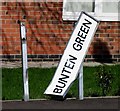
Bunten Green sign
That didn't last long!
Image: © Andrew Tatlow
Taken: 18 Apr 2013
0.04 miles
3
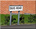
Dilks Road
So new that it is not even on the map!
Image: © Andrew Tatlow
Taken: 18 Apr 2013
0.05 miles
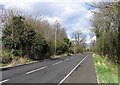
5
Thurmaston Lane
Thurmaston Lane was truncated when the Hamilton Way dual carriageway was built as part of the Leicester Ring Road.
Image: © Andrew Tatlow
Taken: 18 Apr 2013
0.05 miles
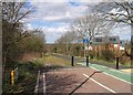
6
Thurmaston Lane
This part of Thurmaston Lane is used by pedestrians and cyclists. The red barriers at what seems to be the end of the lane are for road works associated with the construction of a pelican crossing across the A563, Leicester ring road. Thurmaston Lane continues beyond the photograph, becoming part of said ring road anti-clockwise.
Image: © Tim Glover
Taken: 29 Sep 2016
0.06 miles
7
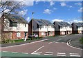
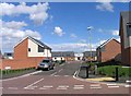
The end of Bunten Green
Soon to be houses one expects.
Image: © Andrew Tatlow
Taken: 18 Apr 2013
0.06 miles
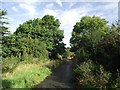
9
Thurmaston Lane
Once a busy main road from Thurmaston to Humberstone but now comes to a dead end.
Image: © Andrew Tatlow
Taken: 18 Apr 2013
0.12 miles
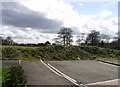
10
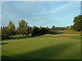
Humberstone Golf Centre
Taken NE of club house looking NE into course
Image: © Chris Shaw
Taken: Unknown
0.17 miles