IMAGES TAKEN NEAR TO
Blount Road, LEICESTER, LE4 8LJ
Introduction
This page details the photographs taken nearby to Blount Road, LE4 8LJ by members of the Geograph project.
The Geograph project started in 2005 with the aim of publishing, organising and preserving representative images for every square kilometre of Great Britain, Ireland and the Isle of Man.

There are currently over 7.5m images from over14,400 individuals and you can help contribute to the project by visiting https://www.geograph.org.uk
Image Map (Loading...)


Getting Data...Please wait
Leaflet Map data © OpenStreetMap
Images are licensed for reuse under creativecommons.org/licenses/by-sa/2.0
Notes
- Clicking on the map will re-center to the selected point.
- The higher the marker number, the further away the image location is from the centre of the postcode.
Image Listing (14 Images Found)
Images are licensed for reuse under creativecommons.org/licenses/by-sa/2.0
Image
Details
Distance
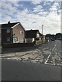
1
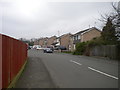
Ridgeway Drive, Thurmaston
Seen from Colby Drive.
Image: © Richard Vince
Taken: 11 Mar 2017
0.09 miles
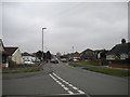
2
Colby Drive, Thurmaston (2)
Seen from the end of Ridgeway Drive.
Image: © Richard Vince
Taken: 11 Mar 2017
0.09 miles
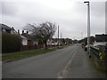
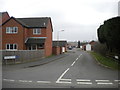
3
Colby Drive, Thurmaston (1)
Seen from the end of Ridgeway Drive.
Image: © Richard Vince
Taken: 11 Mar 2017
0.10 miles
4
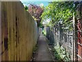
Footpath down the side of the Thurmaston Community Centre
Connecting the play area shown in Image with Silverdale Drive, by the community centre shown in Image
Image: © Ian Calderwood
Taken: 18 Jul 2024
0.12 miles
6
Shenton Close, Thurmaston
A residential cul de sac off Colby Drive.
Image: © Richard Vince
Taken: 11 Mar 2017
0.18 miles
7

Garage on Church Hill Road, Thurmaston
Image: © Richard Vince
Taken: 11 Mar 2017
0.18 miles
9
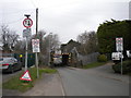
Railway bridge over Church Hill Road, Thurmaston
A very low (9'6") bridge carrying the Midland Main Line north of Leicester over Church Hill Road. Although the flood of which the sign on the left warns was no longer present, the carriageway was still looking quite wet, so presumably it was a fairly recent event.
Image: © Richard Vince
Taken: 11 Mar 2017
0.19 miles
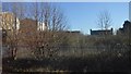
10
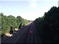
Midland main line railway from Humberstone Lane bridge
The bridge is numbered SPC5/25
Image: © Tim Glover
Taken: 30 Aug 2016
0.19 miles