IMAGES TAKEN NEAR TO
New Parks Boulevard, LEICESTER, LE3 6QH
Introduction
This page details the photographs taken nearby to New Parks Boulevard, LE3 6QH by members of the Geograph project.
The Geograph project started in 2005 with the aim of publishing, organising and preserving representative images for every square kilometre of Great Britain, Ireland and the Isle of Man.

There are currently over 7.5m images from over14,400 individuals and you can help contribute to the project by visiting https://www.geograph.org.uk
Image Map
Images are licensed for reuse under creativecommons.org/licenses/by-sa/2.0
Notes
- Clicking on the map will re-center to the selected point.
- The higher the marker number, the further away the image location is from the centre of the postcode.
Image Listing (19 Images Found)
Images are licensed for reuse under creativecommons.org/licenses/by-sa/2.0
Image
Details
Distance
1
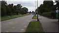
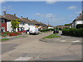
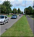
A563 Leicester Ring Road
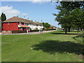
A wide expanse of grass separates the ring road from New Parks Boulevard.
Image: © Peter Whatley
Taken: 7 May 2009
0.05 miles
3
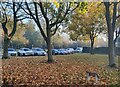
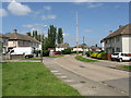
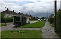
Small open space along New Parks Boulevard, Leicester
Image: © Mat Fascione
Taken: 5 Nov 2020
0.06 miles
5
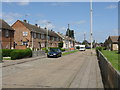
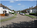
New Parks Boulevard
Classy name for a rather downbeat estate, separated from the Leicester ring road by an expanse of grass and planted areas.
Image: © Peter Whatley
Taken: 7 May 2009
0.08 miles
7
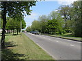
The A563, New Parks Way
Part of Leicester's Outer Ring Road.
Image: © Mat Fascione
Taken: 7 Jul 2007
0.16 miles