IMAGES TAKEN NEAR TO
Packer Avenue, LEICESTER, LE3 3QJ

Introduction

This page details the photographs taken nearby to Packer Avenue, LE3 3QJ by members of the Geograph project.

The Geograph project started in 2005 with the aim of publishing, organising and preserving representative images for every square kilometre of Great Britain, Ireland and the Isle of Man.

There are currently over 7.5m images from over14,400 individuals and you can help contribute to the project by visiting https://www.geograph.org.uk

Image Map


Images are licensed for reuse under creativecommons.org/licenses/by-sa/2.0
Notes
  • Clicking on the map will re-center to the selected point.
  • The higher the marker number, the further away the image location is from the centre of the postcode.

Image Listing (26 Images Found)

Images are licensed for reuse under creativecommons.org/licenses/by-sa/2.0
  • ...
Image
Details
Distance
1
Ratby Lane bridge over railway
The parapets and crash barriers appear to be recent additions to the bridge. Ordnance Survey documents indicate that in 1978 there was a cut mark benchmark levelled at 93.543m above Newlyn Datum on the far end of the parapet
Image: © Roger Templeman Taken: 11 Sep 2018
0.04 miles
2
Benchmark on pumping station, Ratby Lane
The Ordnance Survey cut mark benchmark is low down on the left hand corner of the building and described on the Bench Mark Database at www.bench-marks.org.uk/bm99545
Image: © phil Richards Taken: 11 Sep 2018
0.05 miles
3
Severn Trent pumping station in compound beside Ratby Lane
There is an OS benchmark Image on the front of the pumping station building at its left hand corner
Image: © phil Richards Taken: 11 Sep 2018
0.05 miles
4
Bridge 13 on the Ivanhoe Line
The bridge carries Ratby Lane across the railway.
Image: © Mat Fascione Taken: 29 Apr 2017
0.06 miles
5
Packer Avenue, Leicester Forest East
Image: © Dave Thompson Taken: 28 Sep 2020
0.06 miles
6
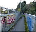
Footbridge across the Ivanhoe Line
This footbridge is next to the B5380 Ratby Lane.
Image: © Mat Fascione Taken: 23 Oct 2016
0.06 miles
7
Midland Railway's Leicester to Coalville line
One of the oldest lines in England. Currently freight only, but with hopes of restoring passenger services.
Image: © Tim Heaton Taken: 1 Jun 2022
0.07 miles
8
Footbridge near the Oak Spinney Business Park
Image: © Mat Fascione Taken: 29 Apr 2017
0.09 miles
9
Level crossing on the Ivanhoe Line
The path is leading to Packer Avenue in Leicester Forest East.
Image: © Mat Fascione Taken: 29 Apr 2017
0.09 miles
10
Public footpath near the Oak Spinney Business Park
Image: © Mat Fascione Taken: 29 Apr 2017
0.10 miles
  • ...