1
'Making a Place', Bede Park
This curious sculpture, representing a rolled up carpet with a map of Leicester painted around it, was designed by Chloe Cookson and Rory McNally; it was inaugurated in July 2000. It forms a centrepiece for Bede Park, which was formerly an industrial site.
Image: © Stephen McKay
Taken: 14 Oct 2007
0.04 miles
2
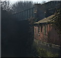
Bridge and factory along the Old River Soar
The bridge carried the former Great Central Railway, later a cycleway and footpath. This is close to where the former Bowstring Bridge was located.
Image: © Mat Fascione
Taken: 29 Dec 2014
0.05 miles
3
Braunstone Gate
A parade of shops at Braunstone Gate in Leicester.
Image: © Malc McDonald
Taken: 26 Feb 2011
0.05 miles
4
Former Great Central Railway, Leicester
Once part of the Great Central main line between London and Sheffield, this viaduct over the River Soar no longer serves a purpose as a footpath - it is now securely fenced off.
Image: © Stephen McKay
Taken: 14 Oct 2007
0.05 miles
5
Leicester Marathon, Bede Park
Almost the Loneliness of the Long Distance Runner; this competitor, trailing most of the field, must have been feeling the pain here at the 19 mile mark in Bede Park. A solitary spectator claps some encouragement.
Image: © Stephen McKay
Taken: 14 Oct 2007
0.05 miles
6
Western Road in Leicester
Image: © Mat Fascione
Taken: 20 Sep 2019
0.07 miles
7
River Soar and railway bridge, Leicester
The Great Central Railway opened through Leicester in 1899, passing to the west of the city centre. The line closed in the 1960s. Infrastructure still survives in some places, such as here near Braunstone Gate where this bridge once carried trains over the River Soar.
Image: © Malc McDonald
Taken: 26 Feb 2011
0.07 miles
8
Bede Park, Leicester
With the sculpture 'Making a Place'. National Cycle route 6 passes through.
Image: © Tim Heaton
Taken: 26 Feb 2012
0.08 miles
9
Derelict bridge and factory
Located along the Old River Soar, this bridge used to carry the Great Central Railway, later a cycleway and footpath. It is next to where the Bowstring Bridge used to be located.
Image: © Mat Fascione
Taken: 29 Dec 2014
0.08 miles
10
Great Central Way cycleway and footpath
Next to the Old River Soar in Leicester.
Image: © Mat Fascione
Taken: 17 Sep 2017
0.08 miles


