IMAGES TAKEN NEAR TO
Amanda Road, LEICESTER, LE2 9HW
Introduction
This page details the photographs taken nearby to Amanda Road, LE2 9HW by members of the Geograph project.
The Geograph project started in 2005 with the aim of publishing, organising and preserving representative images for every square kilometre of Great Britain, Ireland and the Isle of Man.

There are currently over 7.5m images from over14,400 individuals and you can help contribute to the project by visiting https://www.geograph.org.uk
Image Map
Images are licensed for reuse under creativecommons.org/licenses/by-sa/2.0
Notes
- Clicking on the map will re-center to the selected point.
- The higher the marker number, the further away the image location is from the centre of the postcode.
Image Listing (17 Images Found)
Images are licensed for reuse under creativecommons.org/licenses/by-sa/2.0
Image
Details
Distance
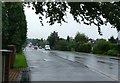
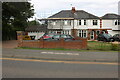
2
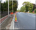
Constructing a pavement along Lutterworth Road
Part of the long running A426 Bus Corridor Project.
Image: © Mat Fascione
Taken: 27 Sep 2013
0.10 miles
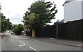
4
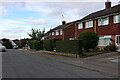
Gilmorton Avenue in Glen Parva, Leicester
Image: © Mat Fascione
Taken: 13 May 2017
0.13 miles
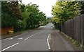
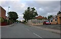
7
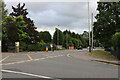
Lutterworth Road, Glen Parva
At the end of Gilmorton Road
Image: © David Howard
Taken: 2 Aug 2022
0.16 miles
8
Lutterworth Road in Glen Parva, Leicester
Image: © Mat Fascione
Taken: 21 Sep 2017
0.16 miles
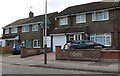
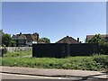
9
Houses on Leicester Road, Glen Parva
The roof has just been finished.
Image: © David Howard
Taken: 2 Jul 2023
0.16 miles
10
Gilmorton Avenue, Glen Parva
The little sign on the house on the right says "Beware of the dogs 24/7 CCTV recording. Friendly people.
Image: © David Howard
Taken: 2 Aug 2022
0.18 miles