IMAGES TAKEN NEAR TO
Burnaston Road, LEICESTER, LE2 8QP
Introduction
This page details the photographs taken nearby to Burnaston Road, LE2 8QP by members of the Geograph project.
The Geograph project started in 2005 with the aim of publishing, organising and preserving representative images for every square kilometre of Great Britain, Ireland and the Isle of Man.

There are currently over 7.5m images from over14,400 individuals and you can help contribute to the project by visiting https://www.geograph.org.uk
Image Map
Images are licensed for reuse under creativecommons.org/licenses/by-sa/2.0
Notes
- Clicking on the map will re-center to the selected point.
- The higher the marker number, the further away the image location is from the centre of the postcode.
Image Listing (24 Images Found)
Images are licensed for reuse under creativecommons.org/licenses/by-sa/2.0
Image
Details
Distance
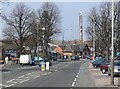
3
Milligan Road.
This is the junction of Burgess Road and Milligan Road in Aylestone, Leicester.
Image: © Mat Fascione
Taken: 3 Apr 2007
0.10 miles
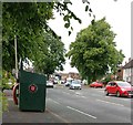
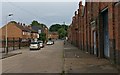
4
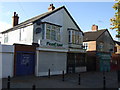
Burgess Road in Aylestone
A typical road of the area, a mix of housing and light industry.
Image: © Mat Fascione
Taken: 31 Jan 2017
0.11 miles
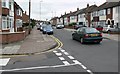
6
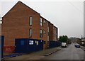
Construction work on Burgess Road, Aylestone
Image: © Mat Fascione
Taken: 31 Jan 2017
0.13 miles
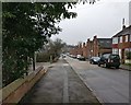
7
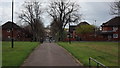
Elston Fields
Looking down the hill towards Saffron Lane
Image: © John Welford
Taken: 26 Apr 2016
0.13 miles
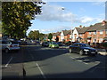
10
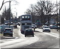
Saffron Lane approaching the Pork Pie Roundabout
Image: © Mat Fascione
Taken: 16 Feb 2014
0.17 miles