IMAGES TAKEN NEAR TO
James Gavin Way, LEICESTER, LE2 4UE
Introduction
This page details the photographs taken nearby to James Gavin Way, LE2 4UE by members of the Geograph project.
The Geograph project started in 2005 with the aim of publishing, organising and preserving representative images for every square kilometre of Great Britain, Ireland and the Isle of Man.

There are currently over 7.5m images from over14,400 individuals and you can help contribute to the project by visiting https://www.geograph.org.uk
Image Map
Images are licensed for reuse under creativecommons.org/licenses/by-sa/2.0
Notes
- Clicking on the map will re-center to the selected point.
- The higher the marker number, the further away the image location is from the centre of the postcode.
Image Listing (16 Images Found)
Images are licensed for reuse under creativecommons.org/licenses/by-sa/2.0
Image
Details
Distance
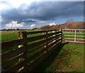
1
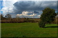
Farmland on the edge of Oadby
The houses in the distance are on Windrush Drive.
Image: © Mat Fascione
Taken: 1 Mar 2014
0.12 miles
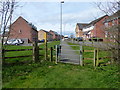
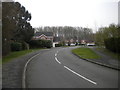
2
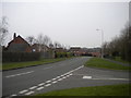
Florence Wragg Way, Oadby Grange
Seen from the junction with Hill Field.
Image: © Richard Vince
Taken: 11 Mar 2017
0.13 miles
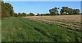
3
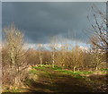
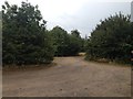
Footpath along Wash Brook
This path runs from Fludes Lane in Oadby, across a mile of farmland to Gartree Road at Great Stretton.
Image: © Mat Fascione
Taken: 1 Mar 2014
0.14 miles
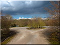
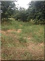
6
Hill Field, Oadby Grange
Off Florence Wragg Way.
Image: © Richard Vince
Taken: 11 Mar 2017
0.14 miles