IMAGES TAKEN NEAR TO
Hamble Road, LEICESTER, LE2 4NX
Introduction
This page details the photographs taken nearby to Hamble Road, LE2 4NX by members of the Geograph project.
The Geograph project started in 2005 with the aim of publishing, organising and preserving representative images for every square kilometre of Great Britain, Ireland and the Isle of Man.

There are currently over 7.5m images from over14,400 individuals and you can help contribute to the project by visiting https://www.geograph.org.uk
Image Map
Images are licensed for reuse under creativecommons.org/licenses/by-sa/2.0
Notes
- Clicking on the map will re-center to the selected point.
- The higher the marker number, the further away the image location is from the centre of the postcode.
Image Listing (5 Images Found)
Images are licensed for reuse under creativecommons.org/licenses/by-sa/2.0
Image
Details
Distance
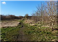
1
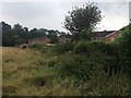
Path across grassland
On the eastern edge of Oadby, the footpath runs from Windrush Drive, across farmland, past Oadby Lodge Farm, and on to Gartree Road.
Image: © Mat Fascione
Taken: 2 Feb 2013
0.17 miles
2
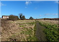
Path on the edge of Oadby
On the eastern edge of Oadby, the footpath runs from Windrush Drive, across farmland, past Oadby Lodge Farm, and on to Gartree Road.
Image: © Mat Fascione
Taken: 2 Feb 2013
0.18 miles
3
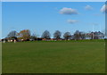
Manor High School playing fields
The houses are along Swale Close in Oadby.
Image: © Mat Fascione
Taken: 2 Feb 2013
0.21 miles
4
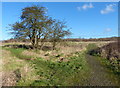
Path to Windrush Drive, Oadby
On the eastern edge of Oadby, the footpath runs from Windrush Drive, across farmland, past Oadby Lodge Farm, and on to Gartree Road.
Image: © Mat Fascione
Taken: 2 Feb 2013
0.22 miles