IMAGES TAKEN NEAR TO
Stoughton Road, LEICESTER, LE2 4FN
Introduction
This page details the photographs taken nearby to Stoughton Road, LE2 4FN by members of the Geograph project.
The Geograph project started in 2005 with the aim of publishing, organising and preserving representative images for every square kilometre of Great Britain, Ireland and the Isle of Man.

There are currently over 7.5m images from over14,400 individuals and you can help contribute to the project by visiting https://www.geograph.org.uk
Image Map
Images are licensed for reuse under creativecommons.org/licenses/by-sa/2.0
Notes
- Clicking on the map will re-center to the selected point.
- The higher the marker number, the further away the image location is from the centre of the postcode.
Image Listing (38 Images Found)
Images are licensed for reuse under creativecommons.org/licenses/by-sa/2.0
Image
Details
Distance
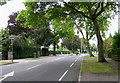
3
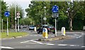
Give way again!
This is one of the two mini roundabouts at the junction of Stoughton Road, Manor Road, and Manor Road Extension. Photographed looking southeast along Manor Road Extension.
Image: © Mat Fascione
Taken: 3 Jun 2007
0.09 miles
4
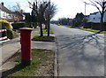
Postbox along Manor Road Extension in Oadby
Image: © Mat Fascione
Taken: 1 Mar 2014
0.10 miles
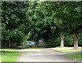
6
Oadby, Leicester LE2
Near to a roundabout formed by Stoughton Road (the B582) and Whitebeam Road, access can be gained to this semi-private road named Blackthorn Road. It is actually a turning off Whitebeam Road. This is the southern-most end of this 'limited access only' road. Although there is pedestrian access along its full length - and vehicular access for residents who live in it - it is a "No Through Road" created by a traffic barrier visible in the distance. The other end of road - for pedestrians and for residents living at the northern-most end of it - is from Manor Road. Much of the land and facilities along the length of the road is/are University property, i.e. halls of residence and sports facilities although twenty or so houses also line some parts of it.
Image: © David Hallam-Jones
Taken: 24 Aug 2014
0.11 miles
7
Oadby, Leicester LE2
Near to a roundabout formed by Stoughton Road (the B582) and Whitebeam Road, access can be gained to this semi-private road, Blackthorn Road. It is a turning off Whitebeam Road. This is approximately 1/6th of the way along the southern-most end of this 'limited access only' road. Although there is pedestrian access along its full length (of 2 miles approximately) - and vehicular access for residents who live in it - it is in fact a "No Through Road" created by this barrier. Access to the other end of road - for pedestrians and for residents living along the longer 2/3rds stretch of it (i.e. the northern-most end of it) is from Manor Road. Much of the land and facilities along the length of the road is/are University property, i.e. halls of residence and sports facilities, although 15-20 houses line parts of its length.
Image: © David Hallam-Jones
Taken: 24 Aug 2014
0.12 miles
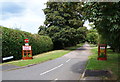
8
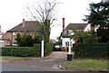
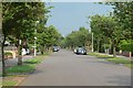
Junction of Manor Road and Stoughton Road
Image: © Andrew Tatlow
Taken: 8 Sep 2011
0.13 miles
10

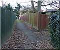
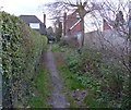
Blackthorn Lane in Oadby
A private Road with a public footpath running along it.
Image: © Mat Fascione
Taken: 1 May 2017
0.14 miles