IMAGES TAKEN NEAR TO
Leicester Road, LEICESTER, LE2 4AA
Introduction
This page details the photographs taken nearby to Leicester Road, LE2 4AA by members of the Geograph project.
The Geograph project started in 2005 with the aim of publishing, organising and preserving representative images for every square kilometre of Great Britain, Ireland and the Isle of Man.

There are currently over 7.5m images from over14,400 individuals and you can help contribute to the project by visiting https://www.geograph.org.uk
Image Map
Images are licensed for reuse under creativecommons.org/licenses/by-sa/2.0
Notes
- Clicking on the map will re-center to the selected point.
- The higher the marker number, the further away the image location is from the centre of the postcode.
Image Listing (31 Images Found)
Images are licensed for reuse under creativecommons.org/licenses/by-sa/2.0
Image
Details
Distance
3
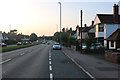
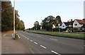
Leicester Road (A6) leaving Oadby for the city of Leicester
Image: © Tim Heaton
Taken: 4 Oct 2022
0.03 miles
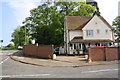
4

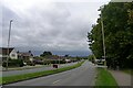
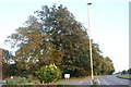
Leicester Road at the junction of Lyndon Road
Image: © David Howard
Taken: 20 Sep 2020
0.05 miles
10
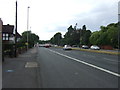
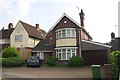
#1 Oadby Hill Drive, off Leicester Road
Image: © Roger Templeman
Taken: 8 May 2018
0.10 miles