1
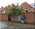
Devana Road, Leicester
Taking its name from the Via Devana, the Roman road which used to enter Leicester from the south-east along a route close to here. The most likely line of the route, however, was along the neighbouring Kimberley Road, as it coincides with the former parish boundary and runs into the Evington Footway.
Image: © Tim Heaton
Taken: 29 Dec 2023
0.04 miles
2
Benchmark on BT telephone exchange, Evington Road
Ordnance Survey cut mark benchmark described on the Bench Mark Database at www.bench-marks.org.uk/bm88693
Image: © phil Richards
Taken: 9 Sep 2017
0.07 miles
3
Telephone Exchange, NW side Evington Road
There is an Ordnance Survey benchmark
Image on the front of the building about 18" from its near corner
Image: © phil Richards
Taken: 9 Sep 2017
0.08 miles
4
Earl Howe Street Leicester
Looking towards Mere Road.
Image: © Terry Roberts
Taken: Unknown
0.11 miles
5
Victoria Park, Stoneygate, Leicester
Taken near the junction of A6 (London Road) and B568 (Victoria Park Road)
Image: © Richard Howell
Taken: 23 Apr 2003
0.11 miles
6
The MKA Dashwood Venue
Formerly a United Reformed Church founded in 1925.
Image: © Tim Glover
Taken: 3 Apr 2016
0.15 miles
7
Electricity substation, Evington Road, Leicester
"A good example of a 1930s art deco electricity sub-station. This was one of several sub-stations constructed in the 1930s to serve the inner city and rapidly expanding suburbs, providing an electricity supply as it began to supersede gas as the main means of lighting." (Leicester City Local Heritage Asset Register)
Image: © Tim Heaton
Taken: 6 Oct 2020
0.16 miles
8
Benchmark on St Philip's Church
Ordnance Survey cut mark benchmark described on the Bench Mark Database at www.bench-marks.org.uk/bm88694
Image: © phil Richards
Taken: 9 Sep 2017
0.18 miles
9
Leicester Coach & Horses
2 Hollington Road.
Image: © the bitterman
Taken: 24 Mar 2010
0.20 miles
10
Rear gates of houses on East Park Road
The rear gates are on Mere Road: East Park Road runs along the fronts of the houses!
Image: © Andrew Tatlow
Taken: 25 Apr 2012
0.20 miles


