1
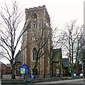
S. Peter's Church, Highfields
Image: © Mat Fascione
Taken: 17 Jun 2007
0.02 miles
2
Church of St Peter, Highfields, Leicester
Classic late 19th century urban church, built 1872-9 to the design of G E Street, a noted Gothic Revival architect. Listed Grade II. There is a benchmark http://www.geograph.org.uk/photo/6036685 at the base of the right hand facing buttress.
Image: © Alan Murray-Rust
Taken: 26 Jan 2019
0.02 miles
3
Bench Mark, Church of St Peter, Highfields, Leicester
See http://www.geograph.org.uk/photo/6036683 for location.
Image: © Alan Murray-Rust
Taken: 26 Jan 2019
0.02 miles
4
West end of St Peter's Church
There is an Ordnance Survey cut mark benchmark
Image on a buttress on the west face. See www.bench-marks.org.uk/bm104442
Image: © phil Richards
Taken: 9 Sep 2017
0.02 miles
5
Tower of St Peter's church
St Peter's church was built in 1872-79 to a design by George Edmund Street. The church is Grade II listed, see: https://historicengland.org.uk/listing/the-list/list-entry/1361047
Image: © Philip Halling
Taken: 20 Nov 2021
0.02 miles
6
Church of St Peter, Highfields, Leicester
The ornate west door. See also http://www.geograph.org.uk/photo/6036683.
Image: © Alan Murray-Rust
Taken: 26 Jan 2019
0.03 miles
7
Leicester - St Peter's Church - tower
Image: © Dave Bevis
Taken: 16 Feb 2014
0.03 miles
8
St Peter's road
Taken whilst waiting for a bus, around the year 2000 looking towards town besides St Peter's church.
Image: © Peter
Taken: 4 Dec 2000
0.03 miles
9
#46 Severn Street at Welland Street junction
There is an Ordnance Survey benchmark
Image at the junction of the house with its front side wall
Image: © phil Richards
Taken: 9 Sep 2017
0.04 miles
10
Leicester, LE1 - Sparkenhoe Street
The Ark World Arts Centre, encapsulating the Sparkenhoe Theatre, occupies the single-storey building on the left. The £660,000 Sparkenhoe Community Theatre was created in 2004 from a disused Unemployment Benefit Office to provide a purpose-built teaching and performance space for nearby Sparkenhoe Primary School and the wider community. The original structure of the building was kept and re-clad to form a foyer and teaching space, with a new structure housing the theatre's auditorium behind it. St Peter's Anglican Church can be seen beyond it.
Image: © David Hallam-Jones
Taken: 9 Dec 2012
0.05 miles


