IMAGES TAKEN NEAR TO
Swinford Road, LUTTERWORTH, LE17 6AP
Introduction
This page details the photographs taken nearby to Swinford Road, LE17 6AP by members of the Geograph project.
The Geograph project started in 2005 with the aim of publishing, organising and preserving representative images for every square kilometre of Great Britain, Ireland and the Isle of Man.

There are currently over 7.5m images from over14,400 individuals and you can help contribute to the project by visiting https://www.geograph.org.uk
Image Map
Images are licensed for reuse under creativecommons.org/licenses/by-sa/2.0
Notes
- Clicking on the map will re-center to the selected point.
- The higher the marker number, the further away the image location is from the centre of the postcode.
Image Listing (9 Images Found)
Images are licensed for reuse under creativecommons.org/licenses/by-sa/2.0
Image
Details
Distance
1
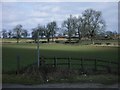
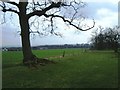
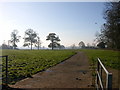
Tomley Hall Farm from Shawell Lane
View of farm from country lane and old footpath sign (footpath X21). The footpath runs along treeline ahead to farm along a track.
Image: © Michael Westley
Taken: 16 Mar 2010
0.04 miles
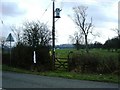
2
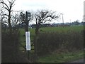
Shawell Road, Footpath
View of Tomley Hall Farm in distance from Shawell Road, at junction with Bridleway.
In a few years time, these footpaths and bridleway will meet a new road and footpath running alongside the M6 / M1 intersection.
Image: © Michael Westley
Taken: 24 Mar 2010
0.13 miles
3
Tomley Hall Farm, from bridleway
Bridleway from M6 / M1 interchange crosses track to farm, before continuing north to Shawell Road.
Image: © Michael Westley
Taken: 24 Mar 2010
0.14 miles
4
Gated approach, Tomley Hall Farm
Track from farm, crosses into field along which bridleway runs down to M6 / M1 interchange (in distance).
Image: © Michael Westley
Taken: 24 Mar 2010
0.16 miles
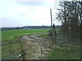
5
Bridleway, approaching M6, near Catthorpe
Running south from Shawell Road, along field boundary towards sliproad from M6 motorway at Catthorpe interchange.
Image: © Michael Westley
Taken: 24 Mar 2010
0.18 miles
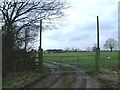
6
Shawell Road, bridleway
On Shawell Road, north of Tomley Hall Farm, a bridleway that runs down to M6 motorway, meets other footpaths coming from the west and south-west.
The bridleway then runs down the border of the field to M6.
Image: © Michael Westley
Taken: 24 Mar 2010
0.22 miles
7
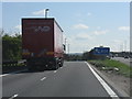
Down to Catthorpe
The sliproad from the M6 to the A14. Logically this should be junction zero on the M6.
Image: © J Whatley
Taken: 21 Apr 2010
0.24 miles
8
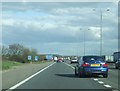
End of the M6
Approaching the eastern end of the M6 were it splints onto the A14 and M1 near to Catthorpe, Leicestershire.
Image: © Claire Evans
Taken: 26 Mar 2009
0.25 miles
9
Shawell
Farm Track and footpath near Tomley Hall Farm on road to Swinford.
Image: © Ian Rob
Taken: 19 Nov 2005
0.25 miles