IMAGES TAKEN NEAR TO
Exton Road, OAKHAM, LE15 8QA
Introduction
This page details the photographs taken nearby to Exton Road, LE15 8QA by members of the Geograph project.
The Geograph project started in 2005 with the aim of publishing, organising and preserving representative images for every square kilometre of Great Britain, Ireland and the Isle of Man.

There are currently over 7.5m images from over14,400 individuals and you can help contribute to the project by visiting https://www.geograph.org.uk
Image Map (Loading...)


Getting Data...Please wait
Leaflet Map data © OpenStreetMap
Images are licensed for reuse under creativecommons.org/licenses/by-sa/2.0
Notes
- Clicking on the map will re-center to the selected point.
- The higher the marker number, the further away the image location is from the centre of the postcode.
Image Listing (16 Images Found)
Images are licensed for reuse under creativecommons.org/licenses/by-sa/2.0
Image
Details
Distance
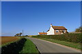
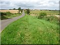
2
Exton Road heading towards Hot Hollow Farm
Image: © Tim Heaton
Taken: 19 Oct 2018
0.02 miles
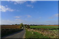
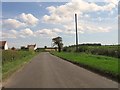
3
Exton Road towards Hot Hollow Farm
This is the road from Empingham to Exton just as it dips down and up to Hot Hollow Farm. It is a typical Midlands road of the Enclosures with wide verges and boundary trees. For more about the Enclosure roads see http://www.geograph.org.uk/photo/2444471
Image: © Marathon
Taken: 23 Sep 2011
0.04 miles
5
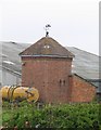
Building with weathervane
In the midst of modern farm buildings is this small brick built structure with a weathervane. One guesses that it contains a water storage tank as there is a pipe that appears to be strategically positioned ready to fill up the yellow tanker!
Image: © Andrew Tatlow
Taken: 7 May 2006
0.04 miles
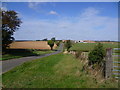
8
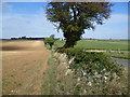
Old stone wall alongside Exton Road
This old wall is alongside the road from Empingham to Exton just as it dips down and up to Hot Hollow Farm. It is a typical Midlands road of the Enclosures with wide verges and boundary trees. For more about the Enclosure roads see http://www.geograph.org.uk/photo/2444471
Image: © Marathon
Taken: 23 Sep 2011
0.14 miles
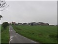
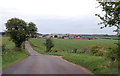
9
Exton Road
Heading north to Hot Hollow Farm.
Image: © Christine Johnstone
Taken: 5 Aug 2012
0.16 miles
10
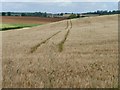
Tracks in the barley, north-east of Exton Road
On the side of a small valley, east of Hot Hollow Farm.
Image: © Christine Johnstone
Taken: 5 Aug 2012
0.17 miles