IMAGES TAKEN NEAR TO
Pytchley Close, OAKHAM, LE15 7NA
Introduction
This page details the photographs taken nearby to Pytchley Close, LE15 7NA by members of the Geograph project.
The Geograph project started in 2005 with the aim of publishing, organising and preserving representative images for every square kilometre of Great Britain, Ireland and the Isle of Man.

There are currently over 7.5m images from over14,400 individuals and you can help contribute to the project by visiting https://www.geograph.org.uk
Image Map
Images are licensed for reuse under creativecommons.org/licenses/by-sa/2.0
Notes
- Clicking on the map will re-center to the selected point.
- The higher the marker number, the further away the image location is from the centre of the postcode.
Image Listing (7 Images Found)
Images are licensed for reuse under creativecommons.org/licenses/by-sa/2.0
Image
Details
Distance
1

RAF Cottesmore perimeter fence
The perimeter fence of RAF Cottesmore crosses the corner of the square. Compare this with the perimeter fence on the other side of the base Image!
The spire of the church of St Mary the Virgin at Greetham is visible in the distance.
Image: © Andrew Tatlow
Taken: 5 Oct 2007
0.04 miles
2

RAF Cottesmore through the fence
A small wood and caravan storage are adjacent to the on-base housing.
Image: © Andrew Tatlow
Taken: 5 Oct 2007
0.05 miles
3

RAF Cottesmore
RAF Cottesmore was opened in 1938. Webpages to be found at http://www.raf.mod.uk/rafcottesmore/
Image: © Andrew Tatlow
Taken: 5 Oct 2007
0.10 miles
4

Kendrew Barracks perimeter fence on 21 August 2016
Compare with Image when this was RAF Cottesmore. The army moved in after the RAF moved out and the airfield is now the home of Kendrick Barracks. 10 years ago a clear strip of land was maintained on the outside of the boundary fence but it is totally overgrown now. Lack of boundary maintenance is apparent at other points round the base.The spire of the church of St Mary the Virgin at Greetham is visible in the distance.
Image: © Andrew Tatlow
Taken: 21 Aug 2016
0.14 miles
5

Gate into Kendrew Barracks on 21 August 2016
The army moved in after the RAF moved out and the airfield is now the home of Kendrick Barracks. 10 years ago a clear strip of land was maintained on the outside of the boundary fence but it is totally overgrown now. Lack of boundary maintenance is apparent at several other points round the base.See Image from 05 October 2007.
Image: © Andrew Tatlow
Taken: 21 Aug 2016
0.19 miles
6

RAF Cottesmore in the Distance
A 2009, zoomed in view from the Thistleton Lane / Park Lane junction. In 2012 the site was taken over by The Army and renamed Kendrew Barracks.
Image: © Stephen Armstrong
Taken: 4 Oct 2009
0.23 miles
7
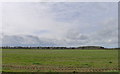
Boundary of Kendrick Barracks
Formerly RAF Cottesmore. MOD land, so difficult to avoid a 'cross-grid' photo!
Image: © Tim Heaton
Taken: 11 Mar 2020
0.24 miles