IMAGES TAKEN NEAR TO
Top Road, MELTON MOWBRAY, LE14 3JH
Introduction
This page details the photographs taken nearby to Top Road, LE14 3JH by members of the Geograph project.
The Geograph project started in 2005 with the aim of publishing, organising and preserving representative images for every square kilometre of Great Britain, Ireland and the Isle of Man.

There are currently over 7.5m images from over14,400 individuals and you can help contribute to the project by visiting https://www.geograph.org.uk
Image Map
Images are licensed for reuse under creativecommons.org/licenses/by-sa/2.0
Notes
- Clicking on the map will re-center to the selected point.
- The higher the marker number, the further away the image location is from the centre of the postcode.
Image Listing (11 Images Found)
Images are licensed for reuse under creativecommons.org/licenses/by-sa/2.0
Image
Details
Distance
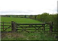
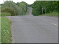
1
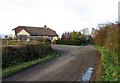
The Bungalow
The Bungalow is at the end of the road to Welby Grange to the left.
Straight on is the original road through to Nottingham Road which is now closed off.
Image: © Andrew Tatlow
Taken: 6 Nov 2010
0.01 miles
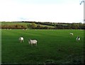
4
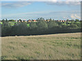
Farmland near Melton Mowbray
Melton is encroaching into the countryside. This housing, in Image, has been built since 2000
Image: © Kate Jewell
Taken: 20 Oct 2005
0.13 miles
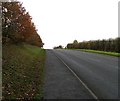
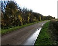
8
Saint Bartholomew's Way
Heading towards Melton Mowbray.
Image: © Mat Fascione
Taken: 30 Jun 2012
0.23 miles
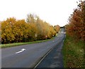
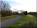
9
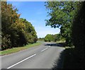
Welby Road northwards
The junction with St Bartholomews Way is in the distance.
Image: © Andrew Tatlow
Taken: 27 Sep 2011
0.23 miles