IMAGES TAKEN NEAR TO
The Drift Road, MELTON MOWBRAY, LE14 2BP
Introduction
This page details the photographs taken nearby to The Drift Road, LE14 2BP by members of the Geograph project.
The Geograph project started in 2005 with the aim of publishing, organising and preserving representative images for every square kilometre of Great Britain, Ireland and the Isle of Man.

There are currently over 7.5m images from over14,400 individuals and you can help contribute to the project by visiting https://www.geograph.org.uk
Image Map
Images are licensed for reuse under creativecommons.org/licenses/by-sa/2.0
Notes
- Clicking on the map will re-center to the selected point.
- The higher the marker number, the further away the image location is from the centre of the postcode.
Image Listing (26 Images Found)
Images are licensed for reuse under creativecommons.org/licenses/by-sa/2.0
Image
Details
Distance
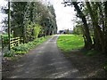
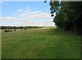
2
Driveway from Pasture Farm across the disused railway line
A former branch line of the Midland and Great Northern Joint Railway
Image: © Tim Heaton
Taken: 24 Oct 2013
0.04 miles
3
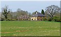
Pasture Farm
In east Leicestershire close to the Rutland and Lincolnshire county boundaries.
Image: © Mat Fascione
Taken: 21 Apr 2008
0.04 miles
4
First footbridge across the River Witham
The footpath leads to Pasture Farm and the Wymondham to South Witham road
Image: © Tim Heaton
Taken: 24 Oct 2013
0.13 miles
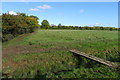
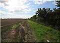
5
Towards Cribb's Lodge Farm
The row of bushes in the middle of the field mark the course of a tributary of the River Witham which has presumably been put in a pipe!
Image: © Andrew Tatlow
Taken: 22 Sep 2016
0.14 miles
6
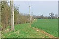
East along the Rutland Round footpath
Also the county boundary of Leicestershire and Rutland.
Image: © Mat Fascione
Taken: 21 Apr 2008
0.16 miles
7
Footpath westwards towards Market Overton
Image: © Andrew Tatlow
Taken: 22 Sep 2016
0.16 miles
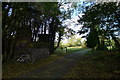
8
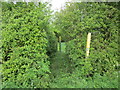
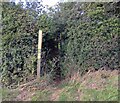
Footpath to Pasture Farm
This small bridge crosses the boundary between Rutland and Leicestershire.
Image: © Jonathan Thacker
Taken: 11 May 2018
0.17 miles
10
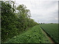
Bridleway to Fosse Lane
Part of the Rutland Round. At this point running along the actual Rutland boundary.
Image: © Jonathan Thacker
Taken: 11 May 2018
0.17 miles