IMAGES TAKEN NEAR TO
Pall Mall, MELTON MOWBRAY, LE13 1RR
Introduction
This page details the photographs taken nearby to Pall Mall, LE13 1RR by members of the Geograph project.
The Geograph project started in 2005 with the aim of publishing, organising and preserving representative images for every square kilometre of Great Britain, Ireland and the Isle of Man.

There are currently over 7.5m images from over14,400 individuals and you can help contribute to the project by visiting https://www.geograph.org.uk
Image Map (Loading...)


Getting Data...Please wait
Leaflet Map data © OpenStreetMap
Images are licensed for reuse under creativecommons.org/licenses/by-sa/2.0
Notes
- Clicking on the map will re-center to the selected point.
- The higher the marker number, the further away the image location is from the centre of the postcode.
Image Listing (23 Images Found)
Images are licensed for reuse under creativecommons.org/licenses/by-sa/2.0
Image
Details
Distance
2
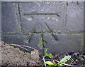
Benchmark on Thorpe Bridge (A607)
Ordnance Survey cut mark benchmark described on the Bench Mark Database at http://www.bench-marks.org.uk/bm41232. Photograph by Maggie and Phil Richards.
Image: © Roger Templeman
Taken: 20 Jan 2012
0.10 miles
3
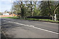
A607 Thorpe Road at Thorpe Bridge
There is an OS benchmark Image on the centre of the bridge parapet
Image: © Roger Templeman
Taken: 10 Apr 2012
0.10 miles

5
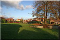
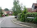
Thorpe Park, Melton Mowbray
A 1980's executive housing estate on the northern edge of town.
Image: © Kate Jewell
Taken: 16 Nov 2005
0.14 miles
7
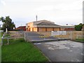
Cars were sold here
Several brands of car have been sold from this site in recent years.
Image: © Andrew Tatlow
Taken: 14 Aug 2010
0.15 miles
8
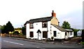
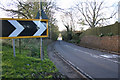
Thorpe Road on the edge of Melton Mowbray
Image: © Mat Fascione
Taken: 14 Apr 2014
0.16 miles
9
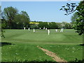
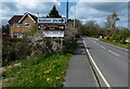
A607 at Thorpe Arnold
The final stretch of the A607 before it hits Melton. The turning at the bottom of the hill, (centre of photograph), leads to Thorpe Park and Scalford.
Image: © Kate Jewell
Taken: 16 Nov 2005
0.17 miles