IMAGES TAKEN NEAR TO
Boyd Road, MELTON MOWBRAY, LE13 0RH
Introduction
This page details the photographs taken nearby to Boyd Road, LE13 0RH by members of the Geograph project.
The Geograph project started in 2005 with the aim of publishing, organising and preserving representative images for every square kilometre of Great Britain, Ireland and the Isle of Man.

There are currently over 7.5m images from over14,400 individuals and you can help contribute to the project by visiting https://www.geograph.org.uk
Image Map (Loading...)


Getting Data...Please wait
Leaflet Map data © OpenStreetMap
Images are licensed for reuse under creativecommons.org/licenses/by-sa/2.0
Notes
- Clicking on the map will re-center to the selected point.
- The higher the marker number, the further away the image location is from the centre of the postcode.
Image Listing (15 Images Found)
Images are licensed for reuse under creativecommons.org/licenses/by-sa/2.0
Image
Details
Distance
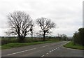
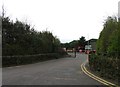
1
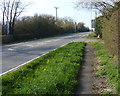
North along Nottingham Road
On the northern edge of the town of Melton Mowbray.
Image: © Mat Fascione
Taken: 29 Mar 2014
0.05 miles
2
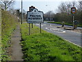
Melton Mowbray sign along Nottingham Road
Image: © Mat Fascione
Taken: 29 Mar 2014
0.07 miles
3
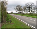
Nottingham Road towards Melton Mowbray
Image: © Andrew Tatlow
Taken: 8 Apr 2012
0.07 miles
4
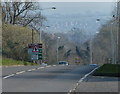
Nottingham Road towards Melton Mowbray
Image: © Mat Fascione
Taken: 29 Mar 2014
0.08 miles
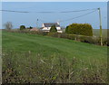

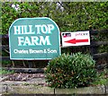
7
Entrance to Hill Top Farm
One doubts that this is still a farm in the conventional sense!
Image: © Andrew Tatlow
Taken: 8 Apr 2012
0.10 miles