IMAGES TAKEN NEAR TO
William Street, LOUGHBOROUGH, LE11 3BX
Introduction
This page details the photographs taken nearby to William Street, LE11 3BX by members of the Geograph project.
The Geograph project started in 2005 with the aim of publishing, organising and preserving representative images for every square kilometre of Great Britain, Ireland and the Isle of Man.

There are currently over 7.5m images from over14,400 individuals and you can help contribute to the project by visiting https://www.geograph.org.uk
Image Map (Loading...)


Getting Data...Please wait
Leaflet Map data © OpenStreetMap
Images are licensed for reuse under creativecommons.org/licenses/by-sa/2.0
Notes
- Clicking on the map will re-center to the selected point.
- The higher the marker number, the further away the image location is from the centre of the postcode.
Image Listing (270 Images Found)
Images are licensed for reuse under creativecommons.org/licenses/by-sa/2.0
Image
Details
Distance
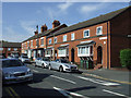
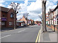
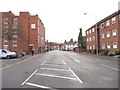
2
Caldwell Street - Frederick Street
Image: © Betty Longbottom
Taken: 10 May 2012
0.05 miles
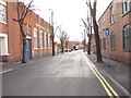
3
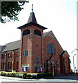
Loughborough United Reformed Church
On Frederick Street at Heathcoat Street.
Image: © Thomas Nugent
Taken: 8 Sep 2014
0.06 miles
4
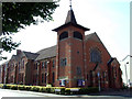
Loughborough United Reformed Church
On Frederick Street at Heathcoat Street.
Image: © Thomas Nugent
Taken: 8 Sep 2014
0.06 miles
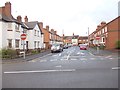
5
Frederick Street - viewed from Granby Street
Image: © Betty Longbottom
Taken: 8 May 2012
0.06 miles
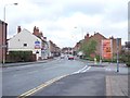
6
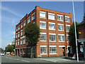
Loughborough University School of Art & Design
On Frederick Street at Packe Street.
Image: © Thomas Nugent
Taken: 8 Sep 2014
0.06 miles
8
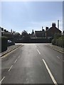
View from Burleigh Road, Loughborough
Image: © Dave Thompson
Taken: 20 May 2020
0.07 miles
9
Frederick Street - viewed from Ashby Road
Image: © Betty Longbottom
Taken: 10 May 2012
0.07 miles
10
Ashby Road - viewed from Frederick Street
Image: © Betty Longbottom
Taken: 10 May 2012
0.07 miles