IMAGES TAKEN NEAR TO
Stanley Street, LOUGHBOROUGH, LE11 2EL
Introduction
This page details the photographs taken nearby to Stanley Street, LE11 2EL by members of the Geograph project.
The Geograph project started in 2005 with the aim of publishing, organising and preserving representative images for every square kilometre of Great Britain, Ireland and the Isle of Man.

There are currently over 7.5m images from over14,400 individuals and you can help contribute to the project by visiting https://www.geograph.org.uk
Image Map
Images are licensed for reuse under creativecommons.org/licenses/by-sa/2.0
Notes
- Clicking on the map will re-center to the selected point.
- The higher the marker number, the further away the image location is from the centre of the postcode.
Image Listing (42 Images Found)
Images are licensed for reuse under creativecommons.org/licenses/by-sa/2.0
Image
Details
Distance
3
Benchmark on #19 Burton Street
Ordnance Survey cut mark benchmark described on the Bench Mark Database at http://www.bench-marks.org.uk/bm63381
Image: © Roger Templeman
Taken: 5 Jan 2015
0.07 miles
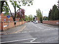
4
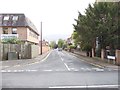
Junction of Burton Street and Park Road
There is an OS benchmark Image near the waiting restriction sign pole on the side of the house
Image: © Roger Templeman
Taken: 5 Jan 2015
0.07 miles
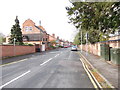
6
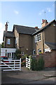
#62 Castledine Street, 'Whitegates'
There is an OS benchmark Image on the boundary wall at its junction with the house.
Image: © Roger Templeman
Taken: 30 Sep 2015
0.09 miles
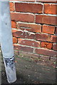
7
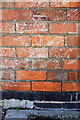
Benchmark on #62 Castledine Street
Ordnance Survey cut mark benchmark described on the Bench Mark Database at http://www.bench-marks.org.uk/bm70595
Image: © Roger Templeman
Taken: 30 Sep 2015
0.09 miles
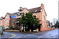
8
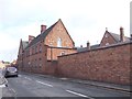
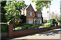
Our Lady's Convent School - Park Road
Image: © Betty Longbottom
Taken: 10 May 2012
0.09 miles
10
Benchmark on Loughborough High School, Burton Walks
Ordnance Survey cut mark benchmark described on the Bench Mark Database at http://www.bench-marks.org.uk/bm63662
Image: © Roger Templeman
Taken: 5 Jan 2015
0.11 miles