1
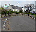
Libanus
A general view of the small settlement of Libanus. The hill in the background is Pen Milan, as far as I can make out from the map: Pen y Fan is shrouded in cloud to the left of the shot.
Image: © John Winder
Taken: 12 Nov 2014
0.02 miles
2
Pen y Fan Close, Libanus
Modern development on the edge of the oddly - named Libanus near Brecon. The road is named after the mountain which dominates the scenery around here.
Image: © John Winder
Taken: 12 Nov 2014
0.04 miles
3
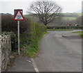
Warning sign - Humps for 125 yards, Pen y Fan Close, Libanus, Powys
The sign text is also in Welsh.
Image: © Jaggery
Taken: 7 Apr 2019
0.04 miles
4
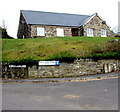
Two street name signs in Libanus, Powys
Left for Cae'r Afallen. Right for Pen y Fan Close.
Image: © Jaggery
Taken: 7 Apr 2019
0.04 miles
5
Former church in Libanus, Powys
In April 2019, this is the former Church in Wales Church of St John built in 1890-1891.
Image: © Jaggery
Taken: 7 Apr 2019
0.04 miles
6
St John's Church, Libanus
The church, built in 1891, is in the middle of the village of Libanus alongside the main A470 just four miles after it leaves Brecon on its way South to Merthyr. It has now been deconsecrated and is being converted into a home.
Image: © Eirian Evans
Taken: 22 Jul 2019
0.04 miles
7
Ordnance Survey Cut Mark
This OS cut mark can be found on the front of the old church. It marks a point 205.594m above mean sea level.
Image: © Adrian Dust
Taken: 21 Jan 2017
0.05 miles
8
Former St John's church in Libanus, Powys
The former Church in Wales church built in 1890-1891 is being converted to residential use in April 2019.
Image: © Jaggery
Taken: 7 Apr 2019
0.05 miles
9
Converted chapel
Image: © Alan Hughes
Taken: 17 May 2021
0.05 miles
10
Warning sign - cattle grid, Glan Tarrell, Libanus, Powys
On the approach to a small grid https://www.geograph.org.uk/photo/6113702 across the road.
A rectangular No Through Road sign is on the back of the sign.
The A470 is in the background.
Image: © Jaggery
Taken: 7 Apr 2019
0.05 miles


