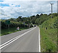
IMAGES TAKEN NEAR TO
Oakwood Close, LLANDRINDOD WELLS, LD1 6TJ

Introduction

This page details the photographs taken nearby to Oakwood Close, LD1 6TJ by members of the Geograph project.

The Geograph project started in 2005 with the aim of publishing, organising and preserving representative images for every square kilometre of Great Britain, Ireland and the Isle of Man.

There are currently over 7.5m images from over14,400 individuals and you can help contribute to the project by visiting https://www.geograph.org.uk

Image Map


Images are licensed for reuse under creativecommons.org/licenses/by-sa/2.0
Notes
  • Clicking on the map will re-center to the selected point.
  • The higher the marker number, the further away the image location is from the centre of the postcode.

Image Listing (47 Images Found)

Images are licensed for reuse under creativecommons.org/licenses/by-sa/2.0
  • ...
Image
Details
Distance
1
Meadow Rise, Crossgates
Meadow Rise is an area of houses on the north side of the A44 in Crossgates, a small village NE of Llandrindod Wells. The street name signs show that Meadow Rise leads to Greenway Close and Village Close.
Image: © Jaggery Taken: 11 Aug 2013
0.06 miles
2
The A44 at Crossgates
Image: © David Howard Taken: 11 May 2019
0.09 miles
3
Old Milestone by the A44, Crossgates/Y Groes, Llanbadarn Fawr parish
Stone post by the A44, in parish of Llanbadarn Fawr (Powys District), Crossgates, 100m from brow of hill West of village, on verge against embankment. Inscription reads:- RHAYADER 7½ MILES PENYBONT 2. Grade II listed by Cadw. Reference Number: 83366 https://cadwpublic-api.azurewebsites.net/reports/listedbuilding/FullReport?lang=&id=83366 Surveyed Milestone Society National ID: RAD_PBRY02
Image: © Milestone Society Taken: Unknown
0.10 miles
4
Distances west from Crossgates, Powys
The sign alongside the A44 shows 8 (miles) to Rhayader, 17 to Llangurig and 42 to Aberystwyth.
Image: © Jaggery Taken: 11 Aug 2013
0.10 miles
5
Guidfa Meadows, Crossgates
Guidfa Meadows is a residential cul-de-sac on the west side of the A483 in Crossgates, a small village NE of Llandrindod Wells.
Image: © Jaggery Taken: 11 Aug 2013
0.10 miles
6
Meadow Rise, Crossgates / Y Groes
It could be England.
Image: © Robin Stott Taken: 16 Oct 2010
0.11 miles
7
Greenway Manor Hotel
Image: © Robin Stott Taken: 16 Oct 2010
0.12 miles
8
Sign for Badgers Green / Maes Y Broch, Crossgates
Image: © David Howard Taken: 11 May 2019
0.13 miles
9
Ordnance Survey Cut Mark
This OS cut mark can be found on the SW parapet of Clywedog Bridge. It marks a point 189.932m above mean sea level.
Image: © Adrian Dust Taken: 24 May 2021
0.14 miles
10
Badgers Green / Maes Y Broch at the junction of the A44
Image: © David Howard Taken: 11 May 2019
0.14 miles
  • ...