
IMAGES TAKEN NEAR TO
Burland Grove, KENDAL, LA9 7LW
Introduction
This page details the photographs taken nearby to Burland Grove, LA9 7LW by members of the Geograph project.
The Geograph project started in 2005 with the aim of publishing, organising and preserving representative images for every square kilometre of Great Britain, Ireland and the Isle of Man.

There are currently over 7.5m images from over14,400 individuals and you can help contribute to the project by visiting https://www.geograph.org.uk
Image Map
Images are licensed for reuse under creativecommons.org/licenses/by-sa/2.0
Notes
- Clicking on the map will re-center to the selected point.
- The higher the marker number, the further away the image location is from the centre of the postcode.
Image Listing (33 Images Found)
Images are licensed for reuse under creativecommons.org/licenses/by-sa/2.0
Image
Details
Distance
1
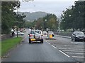
Kendal : Burton Road A65
Looking along Burton Road.
Image: © Lewis Clarke
Taken: 23 Sep 2019
0.04 miles
2
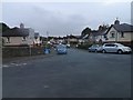
Kendal : Rinkfield
Rinkfield off Burton Road.
Image: © Lewis Clarke
Taken: 23 Sep 2019
0.05 miles
3
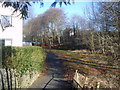
Lancaster Canal
The line of the old canal near Heron Hill.
Image: © Michael Graham
Taken: 1 Mar 2010
0.06 miles
4

George V postbox outside Burton Road Post Office
Postbox No. LA9 167.
See Image] for close up.
Image: © JThomas
Taken: 22 Oct 2016
0.07 miles
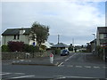
6
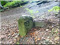
Old Milestone Marker 01-56 F (between bridges 186-185), Lancaster Canal
Old Milestone located by the side of the dry section of the Lancaster Canal.
This milestone is 56 miles from the centre of Preston and 1 mile from Kendal.
Inscription reads:-
26 :: 1
(Miles from Lancaster and Kendal respectively)
Milestone Society National ID: LAN-56
Image: © Cactus Chris
Taken: 1 Jul 2022
0.07 miles
7

George V postbox outside Burton Road Post Office
Postbox No. LA9 167.
See Image] for context.
Image: © JThomas
Taken: 22 Oct 2016
0.07 miles

9

Houses (Nos. 75-78) on SE side of Rinkfield
Ordnance Survey documents indicate that a benchmark levelled at 41.227m above Newlyn Datum was verified in 1954 on the front corner of the nearest house which is now pebbledashed
Image: © Roger Templeman
Taken: 5 Mar 2022
0.08 miles
10

Burton Road, Kendal
Looking along the A65 heading into the town, opposite the leisure centre.
Image: © Stephen McKay
Taken: 27 Dec 2008
0.09 miles