
IMAGES TAKEN NEAR TO
Hill Place, KENDAL, LA9 7HB
Introduction
This page details the photographs taken nearby to Hill Place, LA9 7HB by members of the Geograph project.
The Geograph project started in 2005 with the aim of publishing, organising and preserving representative images for every square kilometre of Great Britain, Ireland and the Isle of Man.

There are currently over 7.5m images from over14,400 individuals and you can help contribute to the project by visiting https://www.geograph.org.uk
Image Map
Images are licensed for reuse under creativecommons.org/licenses/by-sa/2.0
Notes
- Clicking on the map will re-center to the selected point.
- The higher the marker number, the further away the image location is from the centre of the postcode.
Image Listing (73 Images Found)
Images are licensed for reuse under creativecommons.org/licenses/by-sa/2.0
Image
Details
Distance

2

Helmside Road, Oxenholme
Looking north east.
Image: © JThomas
Taken: 26 Sep 2015
0.05 miles

4

Helmside Gardens
Looking along Helmside Road at the junction with Helmside Gardens.
Image: © DS Pugh
Taken: 20 Jul 2019
0.06 miles
5

Benchmark on NE face of former shop Helm Garth on NW side of Helmsdale Road
Ordnance Survey cut mark benchmark levelled at 94.575m above Newlyn Datum verified 1970.
Image: © Roger Templeman
Taken: 10 Jun 2023
0.06 miles
6
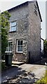
Semi detached house (former shop) on NW side of Helmsdale Road
There is an Ordnance Survey benchmark Image on the side of the house at its rear corner
Image: © Roger Templeman
Taken: 10 Jun 2023
0.06 miles
7

Helmside Gardens, Oxenholme
Off Helmside Road.
Image: © JThomas
Taken: 26 Sep 2015
0.06 miles
8

Helmside Road
Looking along Helmside Road in Oxenholme.
Image: © DS Pugh
Taken: 20 Jul 2019
0.07 miles
9

Kendal from The Helm
View from the lower slopes of The Helm towards the town of Kendal. In the distance rise the mountains of the Lake District.
Image: © Stuart Wilding
Taken: 17 May 2019
0.08 miles
10

Helmside Road, Oxenholme
A useful road linking the B6254 and the A65, which makes it quite busy. Because of its proximity to the railway station, it requires parking restrictions. It is also quite narrow.
Image: © Bill Boaden
Taken: 16 Mar 2013
0.08 miles