
IMAGES TAKEN NEAR TO
Lound Road, KENDAL, LA9 7DZ
Introduction
This page details the photographs taken nearby to Lound Road, LA9 7DZ by members of the Geograph project.
The Geograph project started in 2005 with the aim of publishing, organising and preserving representative images for every square kilometre of Great Britain, Ireland and the Isle of Man.

There are currently over 7.5m images from over14,400 individuals and you can help contribute to the project by visiting https://www.geograph.org.uk
Image Map
Images are licensed for reuse under creativecommons.org/licenses/by-sa/2.0
Notes
- Clicking on the map will re-center to the selected point.
- The higher the marker number, the further away the image location is from the centre of the postcode.
Image Listing (136 Images Found)
Images are licensed for reuse under creativecommons.org/licenses/by-sa/2.0
Image
Details
Distance
1

Houses on Lound Road
Showing position of Postbox No. LA9 9.
See Image] for postbox.
Image: © JThomas
Taken: 22 Oct 2016
0.04 miles
2
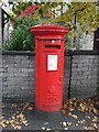
Elizabeth II postbox on Lound Road
Postbox No. LA9 9.
See Image] for context.
Image: © JThomas
Taken: 22 Oct 2016
0.05 miles
3
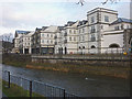
K-Village and the Kent, Kendal
Former shoe manufacturer now a shopping mall.
Image: © Karl and Ali
Taken: 5 Jan 2014
0.05 miles
4

Travelodge, Riverside Place on SW side of Lound Road (A65)
Ordnance Survey documents indicate that a benchmark levelled at 42.063m above Newlyn Datum in 1969 was verified in 1970 on a factory (K Shoes) at this location
Image: © Roger Templeman
Taken: 10 Jun 2023
0.06 miles
5

Old Direction Sign - Signpost by the A6, Lound Road, Kendal parish
Ball finial - 1 arm; HH Day parish halo by the A6, in parish of Kendal (South Lakeland District), by Y-junction with Parkside Road.
Surveyed
Milestone Society National ID: WE_SD5191
Image: © Milestone Society
Taken: Unknown
0.06 miles

8
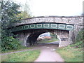
Canal Bridge, Kendal
On the disused Lancaster Canal. The fancy metal section supports the widened road built upon the original bridge, which is now about twice as wide as originally built.
Image: © David Medcalf
Taken: 23 Oct 2005
0.09 miles
9

Building at the entrance to United Utilities depot
Image: © Alexander P Kapp
Taken: 8 Apr 2009
0.09 miles
10

Nether Street, Kendal
Between the gas works and K Shoes when I lived there briefly 50 years ago. Both long gone.
Image: © Chris Morgan
Taken: 12 Nov 2019
0.10 miles