
IMAGES TAKEN NEAR TO
Back Lane, KENDAL, LA9 7AW
Introduction
This page details the photographs taken nearby to Back Lane, LA9 7AW by members of the Geograph project.
The Geograph project started in 2005 with the aim of publishing, organising and preserving representative images for every square kilometre of Great Britain, Ireland and the Isle of Man.

There are currently over 7.5m images from over14,400 individuals and you can help contribute to the project by visiting https://www.geograph.org.uk
Image Map
Images are licensed for reuse under creativecommons.org/licenses/by-sa/2.0
Notes
- Clicking on the map will re-center to the selected point.
- The higher the marker number, the further away the image location is from the centre of the postcode.
Image Listing (163 Images Found)
Images are licensed for reuse under creativecommons.org/licenses/by-sa/2.0
Image
Details
Distance
1

Benchmark on north face of #2 Castle Street
Ordnance Survey cut mark benchmark levelled at 44.301m above Newlyn Datum verified 1970
Image: © Roger Templeman
Taken: 16 Mar 2024
0.04 miles
2

Castle Crescent, Kendal
These houses have a communal green where the washing is hung out to dry in the traditional way. The yellow flowers are of course dandelions.
Image: © Humphrey Bolton
Taken: 7 May 2006
0.04 miles

4
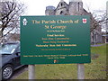
The Parish Church of St George, Kendal, Sign
Image: © Alexander P Kapp
Taken: 23 Feb 2010
0.04 miles
5

St George's Parish Community Church, Kendal
Interior view looking southeast.
Image: © The Carlisle Kid
Taken: 16 May 2015
0.04 miles
6

St George's Parish Community Church, Kendal
The organ - constructed in 1883 by local maker Wilkinson & Sons.
Image: © The Carlisle Kid
Taken: 16 May 2015
0.04 miles
7

St George's Parish Community Church, Kendal
War memorial.
Image: © The Carlisle Kid
Taken: 16 May 2015
0.04 miles
8

St George's Parish Community Church, Kendal
View southeast from the gallery.
Image: © The Carlisle Kid
Taken: 16 May 2015
0.04 miles
9

Castle Crescent
This group of houses, which look to be early 19th century have a communal drying ground in front which was being put to good use.
Image: © Christopher Hall
Taken: 1 Sep 2015
0.04 miles
10

Victorian postbox on Thorny Hills. Kendal
Postbox No. LA9 60.
See Image] for close up.
Image: © JThomas
Taken: 22 Oct 2016
0.05 miles