
IMAGES TAKEN NEAR TO
Kentdale Road, KENDAL, LA9 6JR
Introduction
This page details the photographs taken nearby to Kentdale Road, LA9 6JR by members of the Geograph project.
The Geograph project started in 2005 with the aim of publishing, organising and preserving representative images for every square kilometre of Great Britain, Ireland and the Isle of Man.

There are currently over 7.5m images from over14,400 individuals and you can help contribute to the project by visiting https://www.geograph.org.uk
Image Map
Images are licensed for reuse under creativecommons.org/licenses/by-sa/2.0
Notes
- Clicking on the map will re-center to the selected point.
- The higher the marker number, the further away the image location is from the centre of the postcode.
Image Listing (4 Images Found)
Images are licensed for reuse under creativecommons.org/licenses/by-sa/2.0
Image
Details
Distance
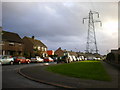
2

Kendal
View of the town from the triangulation pillar on Hay Fell / Benson Knott.
Image: © Richard Webb
Taken: 13 Feb 2009
0.12 miles
3

Wainwright House, Fowl Ing
Wainwright House, Fowl Ing Lane, where Betty McNally, the second wife of the renowned fell-walker and author Alfred Wainwright once lived. The house itself was once known as Fowl Ing, Ing meaning a meadow in Old Norse, it was here that Wainwright recovered from a bout of pneumonia.
Image: © Sue Adair
Taken: 10 Apr 2014
0.16 miles
4

2 Broad Ing
A totally undistinguished "council semi" on the Sandylands estate. But wait - in the fullness of time a blue plaque should appear on the nearer house saying "David R. Starkey, historian and controversy generator lived here throughout his school days". The house was probably built soon after World War 2 and the Starkeys may well have been the first occupants.
Image: © Roger W Haworth
Taken: 22 Dec 2011
0.16 miles