
IMAGES TAKEN NEAR TO
Northgate, KENDAL, LA9 6HY
Introduction
This page details the photographs taken nearby to Northgate, LA9 6HY by members of the Geograph project.
The Geograph project started in 2005 with the aim of publishing, organising and preserving representative images for every square kilometre of Great Britain, Ireland and the Isle of Man.

There are currently over 7.5m images from over14,400 individuals and you can help contribute to the project by visiting https://www.geograph.org.uk
Image Map
Images are licensed for reuse under creativecommons.org/licenses/by-sa/2.0
Notes
- Clicking on the map will re-center to the selected point.
- The higher the marker number, the further away the image location is from the centre of the postcode.
Image Listing (25 Images Found)
Images are licensed for reuse under creativecommons.org/licenses/by-sa/2.0
Image
Details
Distance
2

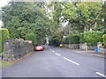
2 Broad Ing
A totally undistinguished "council semi" on the Sandylands estate. But wait - in the fullness of time a blue plaque should appear on the nearer house saying "David R. Starkey, historian and controversy generator lived here throughout his school days". The house was probably built soon after World War 2 and the Starkeys may well have been the first occupants.
Image: © Roger W Haworth
Taken: 22 Dec 2011
0.12 miles


6
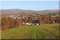
Kendal Castle
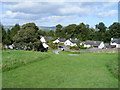
View north from Kendal Castle.
Image: © Wayland Smith
Taken: 2 Dec 2014
0.17 miles
7

Sandylands Road, Kendal
An attractive stone-built terrace near Kendal railway station.
Image: © Mary and Angus Hogg
Taken: 21 Apr 2018
0.19 miles
8

Stockbeck Mill
Marked as Stock Beck Leather Works on 1914 OS map; 1898 map shows undeveloped land (see old-maps website https://www.old-maps.co.uk/#/Map/352100/493180 ).
Image: © Rose and Trev Clough
Taken: 19 Apr 2016
0.20 miles
9
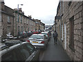
Walking up Ann Street
Lined by terraced houses built of local limestone. Kendal is often regarded as a 'gateway' to the Lake District but it still feels a little odd to be walking around Kendal in our fell walking garb!
Image: © Karl and Ali
Taken: 5 Jan 2014
0.23 miles
